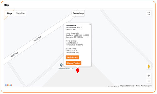
Each LevelSender obtains GPS coordinates from the cellular network based on the location of the nearest cellular tower. From this, a Map is created which displays all device locations in your account. You can display in Map, Satellite or Street View. You can zoom in and out, and drag to different device locations. To re-center, click Center Map.
Selecting a device from the map will display a pop-up with information from that LevelSender, including the serial number, location, and the latest report information including the LevelSender time, internal barometer reading, and the data from the connected datalogger(s).
Note:
The location icons on the map will indicate by colour if an alarm condition has been set and/or triggered for that device.
From the pop-up you can also Go To the Project to access the Project View for more details or make edits, or Change Position of the LevelSender by entering custom GPS coordinates, or manually dragging its position on the map.
Note:
You can also override the LevelSender GPS coordinates and apply custom GPS coordinates to your LevelSender in the Remote LevelSender Changes Section 5.3.

Figure 3-4 Solinst Cloud Dashboard – Map


