February 6, 2025
Solinst Acquires Eureka Water Probes, Expanding Water Monitoring Solutions
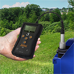
Solinst Canada Ltd. is excited to announce it has acquired Eureka Water Probes, a respected provider of surface water monitoring solutions. Effective February 1, 2025, Eureka Water Probes will become Solinst Eureka LLC. This acquisition broadens Solinst's product portfolio, reinforcing its commitment to comprehensive water monitoring solutions.
This acquisition merges Solinst's groundwater expertise with Eureka Water Probes' surface water knowledge, creating a comprehensive range of innovative products and services. This is an exciting development, combining Eureka Water Probes' strong reputation with Solinst's existing solutions for a holistic approach to water resource management.
The transition will be seamless for Eureka Water Probes customers. Key highlights:
- Continuity of Staff: Stuart Garner and the Eureka Water Probes team remain in place.
- Unchanged Processes: Current processes and operations continue without interruption.
- Seamless Transition: Solinst is committed to a smooth transition.
Solinst is confident this acquisition will create significant value for customers, accelerating innovation and delivering more comprehensive water monitoring solutions.
For more information about Solinst Eureka, please visit: https://www.solinst.com/eureka

December 10, 2024
FLUTe Acquired by Solinst Canada Ltd.
Solinst Canada Ltd, is pleased and excited to announce the recent acquisition of Flexible Liner Underground Technologies (FLUTe). Effective Dec. 2, 2024 the new organization will do business as Solinst Flute LLC.
FLUTe and Solinst Canada have long been friendly competitive manufacturers of Multilevel Groundwater Monitoring Systems. As the manufacturer of the Waterloo Multilevel System for over 40 years, and the CMT Multilevel System since 1999, Solinst is in a unique position to grow that field with the acquisition of FLUTe. This is a great opportunity, enabling us to offer clients with the most options and the best technologies for multilevel groundwater monitoring projects around the world.
Solinst Flute LLC is committed to:
- Retaining all current Production and Field Operations staff.
- Supporting all existing product warranties.
- Delivering the highest quality technologies and customer service you have come to expect.
We are excited about the opportunities this integration presents for our clients and partners. Should you have any questions, please feel free to reach out to me directly or your usual contact at either Solinst Canada or Flute.
Thank you for your continued trust and support.
Jim Pianosi
President
Solinst Canada Ltd.
September 5, 2024
Assessing Coastal Flood Vulnerability to Sea Level Rise Enhanced by Extreme Events in Preferential Flow Pathways
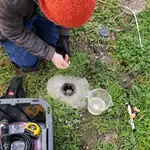
James Jacobs, a PhD candidate researcher at the University of California Santa Cruz, is investigating whether utility trenches contribute to increased vulnerability to coastal flooding in the San Francisco Bay Area.
He aims to establish baseline metrics for coastal flooding processes related to sea level rise and extreme events by analyzing groundwater and surface water data. Three vulnerable study areas were identified. Sixteen groundwater monitoring wells and surface water sampling locations were installed. Jacobs used Solinst Leveloggers to collect data at the surveyed locations.
During the investigation, groundwater responses to extreme rains and high tides were observed, indicating increased community vulnerability to sea level rise and extreme events, especially in areas with preferential pathways. This research underscores the need for a comprehensive, long-term data collection effort to better predict and mitigate coastal flood risks at a community level.
Read the full article in our ON THE LEVEL Blog: https://www.solinst.com/onthelevel-news/water-level-monitoring/water-level-datalogging/assessing-coastal-flood-vulnerability-to-sea-level-rise/
August 20, 2024
Solinst Water Level temperature Sensor Now Even More Versatile With 4-20mA
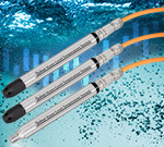
The Solinst 301 Water Level Temperature Sensor provides the option of highly accurate water level transmission using multiple protocols for a wide variety of applications. With the addition of a simple adaptor, the 301 WLTS is now even more versatile with the option to program it with 4-20 mA protocol. This adds to its ability that already includes MOBBUS and SDI-12 compatibility. The compact, all-in-one submersible hydrostatic level transmitter provides continuous, stable water level and temperature readings, with options for absolute and gauged pressure sensors. With 0.05% FS accuracy, six pressure ranges up to 200 m, and a 1/4" NPTM threaded connection, it's easy to integrate into existing monitoring systems.
For more information on the 301 Water Level Temperature Sensor, visit: https://www.solinst.com/products/dataloggers-and-telemetry/301-water-level-temp-sensor/water-level-temp-sensor.php
July 19, 2024
Solinst Releases New Bladder Pumps with Easy-to-Replace Bladder Cartridges
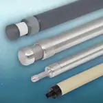
We are excited to announce a NEW simplified design for our Model 407 Bladder Pumps. Our pumps now feature Santoprene® bladder cartridges that are quick and easy to replace in the field – no tools required. Santoprene's chemical resistance and inert properties make the bladders suitable for harsh environments and potable water applications. They are resilient and flexible, ideal for repeated, long-term use. In addition, back by popular demand, the NEW PVC Bladder Pumps are low cost and are excellent for metals sampling and in harsh, corrosive environments. Solinst Model 407 Bladder Pumps provide consistent, accurate, reliable groundwater samples in all applications. Ensuring no air/water contact during operation, the pumps are ideal for VOC and low-flow groundwater sampling.
To learn more about our new Bladder Pumps, visit: https://www.solinst.com/products/groundwater-samplers/407-bladder-pumps/
June 27, 2024
Assessing Low-Temperature Geothermal Potential with Temperature Logging
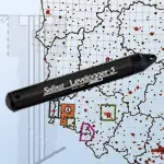
The Polish Geological Survey undertook a study to evaluate the country's potential for low-temperature geothermal energy in response to the increasing demand for clean, carbon-free energy. As part of the study, quarterly temperature profiling was conducted using a Levelogger 5. Temperature measurements were taken in observation boreholes located in diverse regions across the country. The research findings have supplied valuable data for the creation of low-temperature geothermal potential maps for the studied areas in Poland, which will help shape the future of energy in the country.
Read more in our ON THE LEVEL Blog: https://www.solinst.com/onthelevel-news/water-level-monitoring/water-level-datalogging/assessing-geothermal-potential-with-temperature-logging/
June 20, 2024
MG360 Announces Patio Naming from Generous Gift
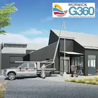
A generous contribution of $250,000 from Solinst Canada Ltd. and the Belshaw Family in May to the University of Guelph will name the Outdoor Education Patio at the new Morwick G360 Groundwater Research Centre. This remarkable gift is a testament to their commitment to advancing worldwide groundwater research.
Solinst Canada Ltd. has been a pioneer in manufacturing high-quality groundwater instrumentation since 1980, driven by the vision of company president Doug Belshaw. Their dedication to innovation and precision has been instrumental in shaping the field of hydrogeology.
"This transformative space embodies Solinst's commitment to advancing experiential learning and community engagement," says Dr. Beth Parker, engineering professor and director of MG360. "By providing a platform for innovative learning and public outreach, it will deepen our understanding of the Guelph aquifer system and foster stronger ties between academia and the community."
The Outdoor Education Patio serves as an extension of our classroom space. It features a fully functional monitoring borehole and will be utilized for outdoor experiential learning across academic levels and public outreach initiatives. Students and professionals alike will engage in hands-on demonstrations, test new tools and collect vital data on the Guelph aquifer system.
"We extend our heartfelt gratitude to Solinst Canada Ltd. and the Belshaw Family for their unwavering support in propelling groundwater research forward. Together, we embark on a journey of discovery and collaboration that will leave a lasting impact on generations to come."
https://www.uoguelph.ca/engineering/news/2024/06/mg360-announces-patio-naming-generous-gift
May 15, 2024
SDC-24 Was a Huge Success with Record Attendance!
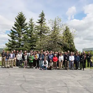
At Solinst, our distributors are integral to our commitment to providing exceptional customer service to our clients worldwide. As such, we are delighted with the Solinst Distributor Conference 2024 turnout! We brought together over 40 distributors from around the world, including Australia, China, Vietnam, Philippines, Pakistan, South Africa, Poland, Netherlands, Estonia, Czech Republic, Lithuania, France, Brazil, Peru, and Mexico, as well as our connections in the US and here in Canada. It was great to see everyone come together to learn and have fun during our 3-day event. We also had the pleasure of having Murray Einarson, Principal at Haley and Aldrich, give an informative talk on the importance of high-resolution monitoring and multilevel systems. We want to thank all the participants and our employees for their commitment to making this event a success. We couldn't have done it without you!
March 21, 2024
Simplify Monitoring, Expand Networks & Extend Data Management with Solinst Cloud
We are excited to introduce Solinst Cloud, a sophisticated cloud-based platform to simplify data management and storage. It is designed to adapt to your needs and expand as your water monitoring networks grow. Data is kept secure, allowing you to control access and extend data management to team members as needed.
Managing and organizing all your data and monitoring projects in one central location has never been easier. Solinst Cloud smartly organizes your information, putting important data at your fingertips. Navigate your way through the user-friendly Dashboard with ease, quickly reaching critical details such as alarm triggers and the latest reports. Solinst Cloud supports LevelSender 5 network communications and seamless configuration of your telemetry systems and monitoring networks.
To learn more about Solinst Cloud, visit:
https://www.solinst.com/products/dataloggers-and-telemetry/solinst-cloud/solinst-cloud.php
March 6, 2024
Leveloggers Ideal for Hydrogeological Monitoring in Polish Mines
Researchers at the Institute of Open Cast Mining in Poland performed several studies to determine the suitability of Solinst Levelogger water Level dataloggers for hydrogeological monitoring of their mining operations. Through pumping tests and other studies, they showed that continuous, high-frequency water level data is critical to accurately track the effects of mining operations on groundwater resources and surface water-groundwater interaction.
Check out the article that was published about their findings in Discovery Mining in our blog:
https://www.solinst.com/onthelevel-news/water-level-monitoring/water-level-datalogging/leveloggers-ideal-for-hydrogeological-monitoring-at-polish-mines/
October 23, 2023
New Versatile Submersible Water Level Transmitter from Solinst
Solinst is excited to introduce the Solinst Model 301 Water Level Temperature Sensor, providing the option of highly accurate water level transmission using multiple protocols, including MODBUS and SDI-12.
This compact, all-in-one submersible hydrostatic level transmitter provides continuous water level and temperature readings using absolute (non-vented) or gauged (vented) pressure sensors. Accuracy is 0.05% FS with six pressure ranges (5–200 m) and communication cable assemblies available in lengths up to 300 metres.
Sensors are enclosed in a 316L stainless steel housing with double o-ring seals to prevent leaks, and a Faraday cage design to protect against power surges and lightning. A 1/4" NPTM threaded connection provides the option of attaching to pipes/conduits.
With the fastest output rate on the market at 1 second, the Water Level Temperature Sensor is easy to integrate into existing monitoring systems, e.g., SCADA or PLC. Measure hydrostatic liquid levels long-term in both industrial and environmental applications.
To learn more about the Solinst Model 301 Water Level Temperature Sensor, visit:
https://www.solinst.com/products/dataloggers-and-telemetry/301-water-level-temp-sensor/water-level-temp-sensor.php
August 21, 2023
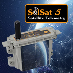
Discover Anywhere Monitoring using the new SolSat 5 Satellite Telemetry System
SolSat 5 is an advanced telemetry system that leverages Iridium satellite technology to provide global connectivity for your remote water monitoring projects. The Model 9700 SolSat 5 uses TextAnywhere two-way global satellite messaging to send data from Solinst dataloggers in the field to a secure web portal where you have complete control of your data. Select a low-cost data plan of your choice through Solinst.
The SolSat 5 is compact, lightweight, and features a robust weatherproof enclosure. It is installed anywhere with very little site preparation. A built-in solar panel extends the battery life, while a barometric sensor allows for automatically compensated water level data to be reported.
The SolSat 5 is simple to set up with Solinst 5 Series dataloggers using an integral, secure Wi-Fi App on your smartphone or laptop. The app allows viewing, scheduling, and configuration wirelessly from your browser. You can also set high or low-level alarms.
To learn more about SolSat 5 Satellite Telemetry, visit:
https://www.solinst.com/products/dataloggers-and-telemetry/solinst-telemetry-systems/9700-solsat/solsat.php
March 9, 2023
Levelogger Data Critical for Water and Leachate Management at a Queensland Landfill
After a significant rainfall event at a landfill in southeast Queensland, Australia, it was determined that more detailed data was required in order to properly assess groundwater trends and responses to future events. Solinst Levelogger 5 water level dataloggers were installed across the groundwater monitoring network. Based on the high quality data and understanding gained from the Leveloggers, more loggers were installed in the sites surface water and leachate level monitoring systems. Overall, Levelogger 5 dataloggers have allowed for more detailed monitoring and analysis of groundwater, surface water, and leachate.
January 10, 2023
Solinst Leveloggers Perform Well in High Elevation Alpine Lake Monitoring
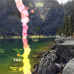
Kootenay Watershed Science (KWS) has expanded their project to further understand how climate change will influence their region's watersheds, by adding alpine lake monitoring stations.
Learn how Leveloggers are installed to help determine the correlation between lake water levels and the nearby creeks. KWS has been using Leveloggers since 2012, and are pleased with the performance in these remote sites.
"At this remote, high elevation station, we need to be completely confident in our loggers. The Solinst loggers have performed flawlessly despite the challenges of this environment," says Paul Saso, Hydrologist with KWS.
Read More in our On The Level Blog:
https://www.solinst.com/onthelevel-news/water-level-monitoring/water-level-datalogging/kootenay-watershed-science-expands-program-to-include-alpine-lake-monitoring/
December 7, 2022
Reclaiming and Remediating Abandoned Mine Drainage for Clean Water Use
Read how the Eastern Pennsylvania Coalition for Abandoned Mine Reclamation are using Solinst Levelogger water level dataloggers to monitor an abandoned mine tunnel as an option for consumptive water use mitigation. This would create a new clean water source for the community, while reclaiming the abandoned mine feature as a valuable resource.
Read this article in our ON THE LEVEL Blog:
https://www.solinst.com/onthelevel-news/water-level-monitoring/water-level-datalogging/reclaiming-and-remediating-abandoned-mine-drainage-for-clean-water-use/
September 7, 2022
Planting 51 Trees Speeds Up Toluene Cleanup Efforts: High-Res Groundwater Monitoring Tracks its Success
The site of a unique research project headed by the University of Guelph Morwick G360 Groundwater Research Group is being aided by the installation of Solinst 615ML Multilevel Drive-Point Piezometers. The Multilevel Piezometers will be used to take vapour samples during the study, which is to evaluate the use of trees as a viable tool for cleaning up toluene contamination in a fractured bedrock aquifer.
Read more about the plant-assisted attenuation process in our ON THE LEVEL Blog:
https://www.solinst.com/onthelevel-news/groundwater-sampling/multilevel-monitoring/planting-51-trees-speeds-up-toluene-cleanup/
May 19, 2022
Solinst Teams Up With CityKinect to Enhance Cellular Telemetry
Solinst Canada Ltd. is pleased to announce a partnership with CityKinect that enables global cellular connectivity to our Model 9500 4G LevelSender 5 Telemetry Systems. The LevelSender 5 offers a very simple and inexpensive means to collect water level data from remote Solinst dataloggers.
For more information on the LevelSender 5 4G with SIM Card, visit:
https://www.solinst.com/products/dataloggers-and-telemetry/solinst-telemetry-systems/9500-levelsender/articles/citikinect.php
January 19, 2022
New Dedicated Well Cap for the Solinst 12V Submersible Pump now Available!
For long-term monitoring projects and to avoid cross-contamination or decontamination between wells, a 2" well cap assembly is available for dedicated deployment of the 12V Pump. The well cap features quick-connect tubing fittings and an access hole to fit a Solinst Water Level Meter or Levelogger. The 12V Submersible Pump provides an efficient means of purging and obtaining groundwater samples from 2" OD wells. The compact pump can sample from depths of 36.5 m (120 ft) below ground surface, with continuous flow rates up to 13.5 L/min (3.6 US gpm) in shallow applications.
To learn more about the Solinst Model 415 12V Submersible pump, visit:
https://www.solinst.com/products/groundwater-samplers/415-12v-submersible-pump/415.php
December 14, 2021
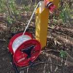
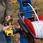
NEW Power Winder: Save Time and Effort in the Field with this Simple Tool
The NEW 101 Power Winder provides both convenience and ease of use for all Solinst reel-mounted devices. The Power Winder is lightweight and easy to attach to small, medium and large Solinst reel frames, and is simple to adjust to fit other Water Level Meters in the market. It is designed to allow effortless winding of longer lengths of tape, cable and tubing. The Power Winder uses a standard power drill or driver to operate – use at a low speed setting for precise level measurements. The Power Winder is simple to remove and use with multiple meters, but is ideal for dedicating to one reel.
To learn more about the 101 Power Winder, visit:
https://www.solinst.com/products/level-measurement-devices/101-power-winder/101-power-winder.php
November 24, 2021
NEW 12V Submersible Pump Provides High Purge Rates & Easy-To-Adjust Flow
The NEW Solinst Model 415 12V Submersible Pump provides an efficient means of purging and obtaining groundwater samples from 2" OD monitoring wells. The short (nominal 6"), compact pump can sample from depths of 36.5 m (120 ft) below ground surface. It is very easy to adjust the continuous flow rates, up to 13.5 L/min (3.6 US gpm) in shallow applications, using the 12V Pump Controller's single dial. The Solinst 12V Submersible Pump is ideal for sampling when using the 3 well volume protocol, or for use when performing constant head tests in high K (hydraulic conductivity) environments.
To learn more about the Solinst Model 415 12V Submersible pump, visit:
https://www.solinst.com/products/groundwater-samplers/415-12v-submersible-pump/415.php
November 10, 2021
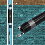
Introducing a Mini Version of the Solinst Low Pressure Pneumatic Packer
Solinst has released a Mini version of the Model 800 Low Pressure Pneumatic Packer! The 800M Mini Packer is 1 ft in length and is designed to fit in nominal 2" OD monitoring wells to temporarily isolate discrete zones for groundwater monitoring and sampling applications – available as a single and straddle packer setup. Its small, lightweight (1.2 lbs) design means minimal weight is added when connecting to Solinst pumps for isolated low flow groundwater sampling. The 800M is ideal for conducting falling head tests, and useful when multiple, shorter intervals need to be isolated for aquifer testing.
To learn more about the new 800M Mini Low Pressure Pneumatic Packers, visit:
https://www.solinst.com/products/groundwater-samplers/800-low-pressure-packers/
October 15, 2021
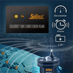
New Software & Firmware Release Enhances LevelSender 5 Telemetry
Solinst has released a new version of LevelSender Software and Firmware, allowing new and current LevelSender 5 Telemetry Systems (built after November 2020) to take advantage of some new great features! Enhancements include activating the internal barometer for automatic compensated water level data reports, the ability to set up high and low-level alarms, the option to export data via FTP to your database, and more. These advancements are in addition to our other recent update to a 4G modem and ready-for-the-field SIM Card option with low-cost Solinst managed data plans.
To learn more about all the new features offered with LevelSender Software Version 1.2.0 and Firmware Version 2.002, visit:
https://www.solinst.com/products/dataloggers-and-telemetry/solinst-telemetry-systems/9500-levelsender/levelsender.php
September 28, 2021
NEW Rugged Data Transfer Device Provides Instant Water Level Readings
The NEW Model 4001 Solinst Readout Unit (SRU) is a rugged, handheld device designed to connect to a deployed Solinst datalogger and display instant water level readings.
It allows a real-time monitoring session to be viewed and saved – independent of the dataloggers internal logging mode. A built-in barometer provides the option of real-time water level readings that are automatically compensated. The real-time logging is a convenient way to view and log reading during an aquifer test.
The SRU can check the status of a datalogger's battery and memory while in the field. It is also a data download and storage device. It has a robust memory to save multiple log files. Saved real-time and log files are transferred to a PC and opened using Levelogger Software.
For more information on the SRU, please visit:
https://www.solinst.com/products/dataloggers-and-telemetry/4001/4001-sru/sru.php
September 1, 2021
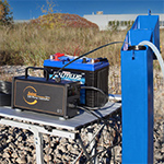
Plug and Play 4G LevelSender 5 Telemetry with Built-in SIM Card
Solinst has released a 4G version of our LevelSender 5 telemetry system, featuring a Solinst SIM card that is activated and preinstalled before shipping to you! The LevelSender 5 is set up for you in advance, simplifying the programming and installation process—it truly is a plug and play solution for remote water level monitoring.
The Solinst SIM Card gives you access to wider network coverage, as it scans multiple service providers automatically selecting the strongest signal for your location. Eliminate frustrations with other service providers and set up a low-cost, competitive data-only plan managed and billed directly through Solinst—never overpay for unused data again!
For more information on the LevelSender 5 4G with SIM Card, visit:
https://www.solinst.com/products/dataloggers-and-telemetry/solinst-telemetry-systems/9500-levelsender/levelsender.php
August 25, 2021
Bladder Pump Helps Monitor Groundwater Contamination Near A Busy Port
Groundwater consulting company GEOSS has taken the lead in an ongoing project to monitor the potential impacts of the aboveground activities on groundwater resources in the Saldana Bay area in Western Cape, South Africa.
GEOSS needed equipment to handle sampling for VOCs at potentially contaminated locations in narrow diameter boreholes. Based on their requirements, they selected a 1" diameter Bladder Pump in a portable sampling setup, which they use to take up to 30 groundwater samples each week.
To read more about this sampling project, check out our ON THE LEVEL Blog: https://www.solinst.com/onthelevel-news/groundwater-sampling/low-flow-groundwater-sampling/bladder-pump-helps-monitor-groundwater-contamination-near-a-busy-port/
August 17, 2021
NEW Model 615 ML Multilevel Drive-Point Piezometer
Solinst is pleased to announce the addition of a multilevel drive-point system to our line of high-resolution vertical profiling tools.
The Model 615 ML Multilevel Drive-Point Piezometer system can provide several monitoring zones in one drive location. The 615 ML Ports have a dual barbed stem that allows the connection of either 3/8" OD or 1/4" OD tubing to create up to 3 or 6 monitoring zones, respectively. The 615 ML Multilevel System is installed using extensions and a Manual Slide Hammer, similar to standard 615 installations, for high-resolution vertical groundwater or soil gas profiling.
To learn more about this simple, inexpensive and effective option to create multiple monitoring points in one shallow installation, visit:
https://www.solinst.com/products/direct-push-equipment/615-drive-point-piezometers/
July 8, 2021
Building Knowledge to Ensure Climate Change Readiness
Detailed water monitoring and planning are required to ensure that communities relying on surface water resources are protected from future climate change impacts. Significant weather and hydrologic events in the north Kootenay Lake area of British Columbia, Canada spurred citizens in the region to start taking an active role in preparing for a changing climate.
This community concern led to the establishment of the Kootenay Watershed Science (KWS) – a community-driven project that has taken the lead in understanding how climate change will impact the small and medium-sized watersheds in their region.
Read more about this program, and how they are using Leveloggers, in our latest blog post: https://www.solinst.com/onthelevel-news/water-level-monitoring/water-level-datalogging/kootenay-watershed-science-climate-change-readiness/
June 2, 2021
NEW Deep Water Discrete Interval Sampler Reaches 1200 m
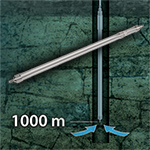
Solinst Canada Ltd. is pleased to announce the release of the Model 425-D Deep Sampling Discrete Interval Sampler for sampling groundwater or open water bodies from submerged depths as much as 1200 m (4000 ft). The 425-D Deep Sampling Discrete Interval Sampler obtains representative samples from a specific zone without the need for purging. The stainless steel sampler is connected to LDPE tubing, mounted on a convenient reel. The sealed sampler is pressurized at depth allowing water to enter. The sampler is vented and sealed before retrieval to surface, maintaining sample integrity.
More information about the new Model 425-D Deep Sampling Discrete Interval Sampler.
April 29, 2021
5 Tips for Getting the Most Accurate Readings from a Sonic Water Level Meter
Get the most accurate depth to static water level readings from your Solinst Model 104 Sonic Water Level Meter by following five helpful tips provided in our latest blog post.
Tips include proper setup for your probe, taking into account your well diameter, knowing your air/water interface temperature, having knowledge of your typical water fluctuation levels, and knowing what's down your well!
Based on the tips, learn how settings can be added in the Sonic Water Level Meter Control Unit to help optimize your water level readings.
Check out the blog post here: https://www.solinst.com/onthelevel-news/water-level-monitoring/manual-water-level-measurements/5-tips-for-getting-the-most-accurate-readings-from-a-sonic-water-level-meter/
March 23, 2021
Introducing the NEW Solinst 104 Sonic Water Level Meter
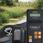
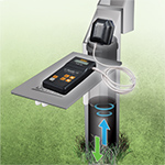
Get a depth to static water level reading in seconds using the NEW Solinst Model 104 Sonic Water Level Meter! The Solinst Sonic Water Level Meter is a portable, acoustic ranging instrument designed to simply and quickly provide measurements down to 600 m (2000 ft), without the need to lower equipment down a well. Ideal for straight, crooked, narrow, hard to access or contaminated wells. The Solinst Sonic Water Level Meter is supplied with a plastic disc for covering larger well openings and a convenient Solinst Field Bag.
For more information on the 104 Solinst Sonic Water Level Meter, visit: https://www.solinst.com/products/level-measurement-devices/104-sonic-water-level-meter/104.php
December 9, 2020
New Portable Field Tables For Your Environmental Monitoring Sites
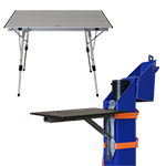
To help keep your equipment organized in the field, Solinst now offers two types of convenient Field Tables to use at any of your environmental monitoring sites. The tables are useful for keeping your instruments off the ground and provide a clean, dry, sturdy, and flat surface to deploy and store your field tools on.
The Well-mount Field Table hooks directly to your standard groundwater monitoring well – it's like an extra hand in the field. It's ideal for supporting Water Level Meters and provides a spot to jot down your well measurements. The Stand-alone Field Table provides a larger surface area, and has adjustable legs to suit your height requirements. It's handy to have on site for groundwater sampling projects or well installations.
Both Field Tables are foldable, compact, lightweight, and easy to transport and come with their own carry bags. These field accessories can be added to any Solinst equipment order and shipped right to your site if needed.
To learn more, visit: https://www.solinst.com/products/field-equipment/880-field-table/field-table.php
October 14, 2020
Water Level Data Helps to Understand the Effects of Climate Change on Alpine Lakes
The Canadian Rocky Mountain Parks are designated as UNESCO World Heritage Sites for their "exceptional natural beauty".
They are known for their scenic mountain peaks, meadows, canyons, caves, hot springs, and glaciers. Their pristine alpine lakes also draw millions of visitors to the parks each year.
But as we hear so often…due to the effects of climate change, these spectacular alpine lakes may also be changing.
Janet Fischer and Mark Olson, professors in the Biology Department at Franklin & Marshall College in Lancaster, Pennsylvania, are leading a research project where Solinst Leveloggers are being used to monitor alpine lakes in Banff and Yoho National Parks to help study the effects of climate change.
Read more about their research in our latest blog post: https://www.solinst.com/onthelevel-news/water-level-monitoring/water-level-datalogging/climate-change-on-alpine-lakes/
September 1, 2020
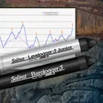
Solinst Canada Introduces NEW Levelogger 5
Solinst Canada Ltd. is pleased to announce the release of their 5th generation Levelogger!
Bringing over 20 years of engineering and design experience with it, everything about the NEW Levelogger 5 is focused on providing high-quality, reliable water level datalogger with the accuracy and ease-of-use expected from Solinst.
The Levelogger 5 features a more robust design, with double-sealed housing construction using high-grade 316 stainless steel. A PFAS-free corrosion-resistant coating, inside and out, provides extra protection.
A redesigned optical interface offers improved datalogger connectivity with communication accessories and Solinst Levelogger Software. An increased memory of 150,000 sets of water level and temperature readings allows for longer, uninterrupted monitoring applications and higher resolution data with more frequent readings.
New tools for convenient in-field communication, including the Field Reader 5, are backwards compatible with previous generation Leveloggers simply by using an Adaptor. An Adaptor is also available for Levelogger 5 dataloggers to work with your existing accessories.
For more information about the new Model 3001 Levelogger 5, please visit: https://www.solinst.com/levelogger/
July 15, 2020
Establishing a Real-Time Groundwater Observatory Network in California
The Hydrologic Sciences Graduate Group at UC Davis established a low-cost, open source network of on-demand aquifer monitoring sites with the help of Solinst LevelSender telemetry systems. Currently, ten LevelSender systems provide groundwater level data to the South American Subbasin Groundwater Observatory. The online Groundwater Observatory allows researchers, water managers, and all stakeholders to access up-to-date water level data. This database better equips those in the region to make appropriate decisions on groundwater management.
To read more about the project, visit the Solinst ON THE LEVEL blog: https://www.solinst.com/onthelevel-news/water-level-monitoring/water-level-datalogging/establishing-a-real-time-groundwater-observatory-network-in-a-california-subbasin/
April 9, 2020
Sustaining Groundwater Resources in a Unique Region of South Africa
Just 200 km north of Cape Town, South Africa, you'll find a unique area that boasts a wide range of landscapes – from rugged mountains to lush river valleys. Groundwater feeds this region. Recently, demand on the high-quality resource has increased. Find out how Solinst Leveloggers are being used to help manage over 50 groundwater abstraction wells used by the rural community.
Read the full story in our ON THE LEVEL Blog: https://www.solinst.com/onthelevel-news/water-level-monitoring/water-level-datalogging/sustaining-groundwater-resources-in-south-africa/
February 13, 2020
New Cable Upgrade for the Solinst 102 Water Level Meter
The Solinst Model 102 Water Level Meter has a new narrow cable featuring a heavy-duty polyurethane jacket. The upgraded cable is extremely durable, with extra abrasion-resistance and flexibility. The yellow cable is distinctly laser-marked each millimeter or every 1/100 ft, offering more visibility in the field. Both the standard 102 and 102M Mini Water Level Meters have the option of a narrow P4 (4 mm diameter) or weighted P10 (10 mm diameter) probe.
To learn more, visit: https://www.solinst.com/products/level-measurement-devices/102-water-level-indicator/
February 12, 2020
New Video Posted: Well Casing & Depth Indicator Dual-Function Probe
The Solinst 105 Well Casing & Depth Indicator features a unique dual-function probe.
Check out our latest YouTube video that shows you how the probe detects metal well casing and measures total well depth: https://youtu.be/krWlf7iYrd8
January 22, 2020
Water Level Data Critical For Successful Coastal Wetland Restoration
Over 90 per cent of historical coastal wetlands in South Central California have been lost due to development — one such area is the former upper arms of the Devereux Slough. A huge restoration project is aiming to restore 100 acres of this land back to its natural state, including over 40 acres of wetland! See how The Cheadle Center for Biodiversity and Ecological Restoration at UCSB is using Levelogger data to track, monitor, and ultimately provide insight on the impacts and success of this major wetland restoration effort.
Read the article in our On The Level Blog: www.solinst.com/onthelevel-news/water-level-monitoring/water-level-datalogging/water-level-data-wetland-restoration/


