Detailed water monitoring and planning are required to ensure that communities relying on surface water resources are protected from future climate change impacts.
Significant weather and hydrologic events in the north Kootenay Lake area of British Columbia, Canada spurred citizens in the region to start taking an active role in preparing for a changing climate.
The Development of Kootenay Watershed Science
This community concern led to the establishment of Kootenay Watershed Science (KWS) – a community-driven project that has taken the lead in understanding how climate change will impact the small and medium-sized watersheds in their region.
The monitoring activities now championed by KWS began as an initiative of the Kaslo and District Community Forest Society in 2007. The program has since changed hands a few times and in early 2020 KWS found its new home as part of the Living Lakes Canada portfolio of projects.
Living Lakes Canada is a national non-profit organization based in the Canadian Columbia Basin that is working towards the long-term protection of Canada’s fresh water with the mission is to normalize water stewardship through community-based water monitoring.
Much of their work has become a grassroots template for aquatic ecosystem monitoring across BC and Canada, and they are affiliated with Living Lakes International, a global network of over 120 non-governmental organizations and stewardship practitioners who share best practices in efforts to protect lakes, rivers, wetlands and watersheds world-wide.
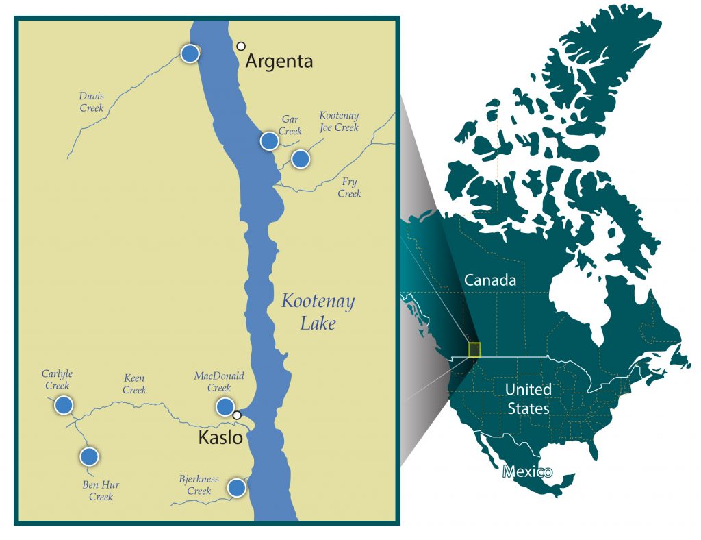
The KWS project focuses on collecting and sharing important data on which to base future decisions in land use and development, conservation, emergency preparedness, water supply allocation, and more. To date, the program has established two high-elevation snow course sites, three climate stations, and seven hydrometric stations. Data is collected on snowpack, precipitation, temperature, water quantity, and more.
KWS datasets now include five continuous streamflow records of around nine years and two more of three and four-year durations. Dedicated volunteers, citizen scientists, and professional hydrologists perform the data collection, sampling and monitoring.
Water Level Data Collection
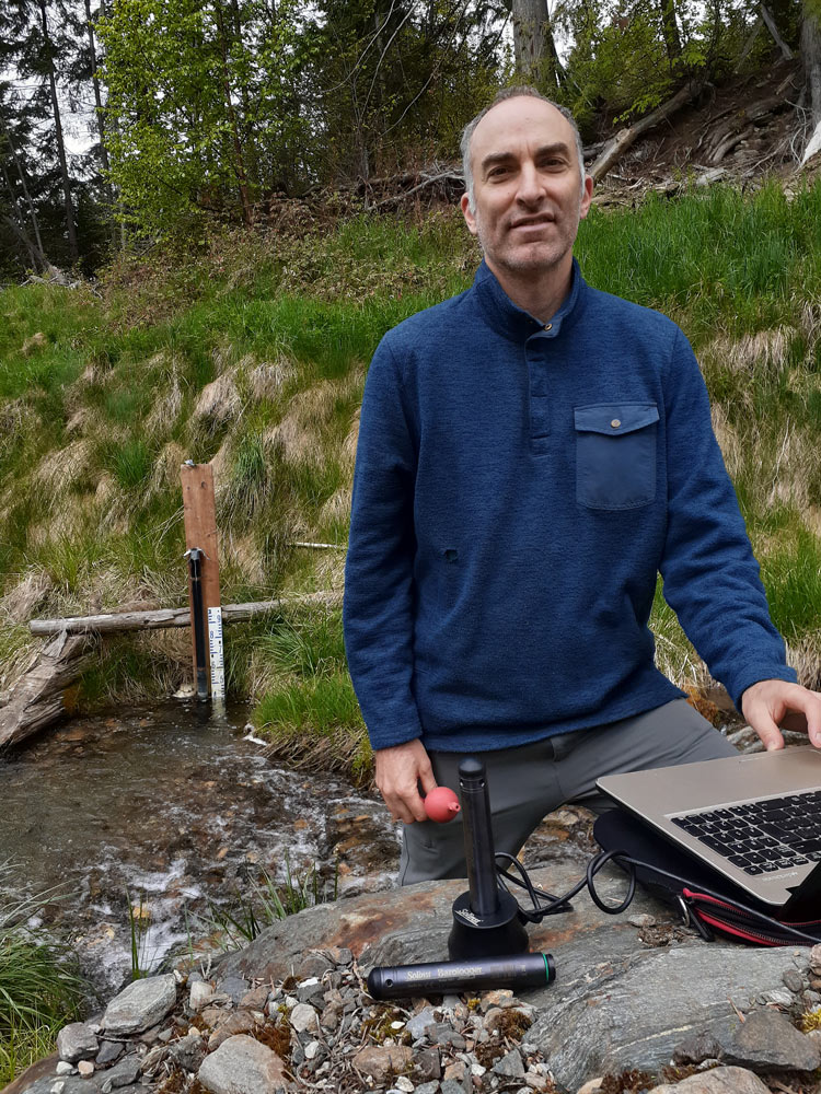
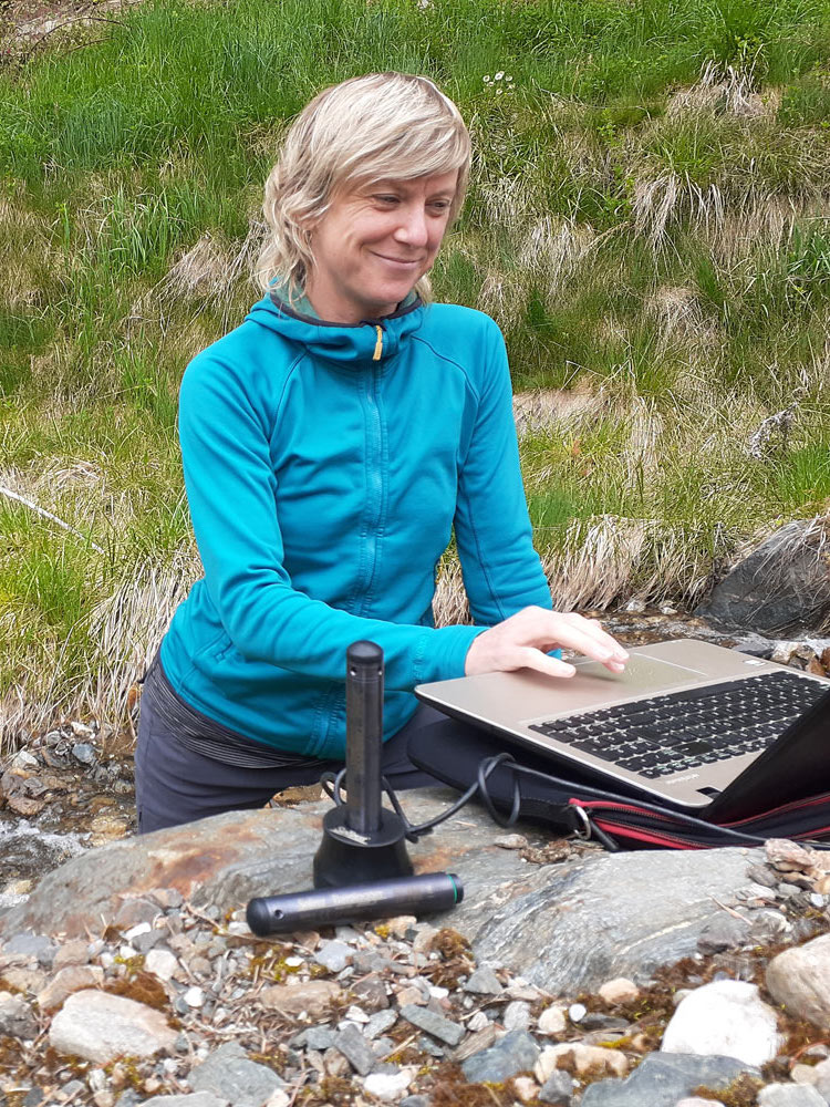
In 2012, Solinst Leveloggers were installed in five KWS hydrometric stations and two more were added at stations in 2017.
The Leveloggers are deployed in streams in either a perforated PVC or steel pipe, combined with a staff gauge. Barologgers are installed nearby to record atmospheric pressure (used to barometrically compensate Levelogger data) as well as air temperature.
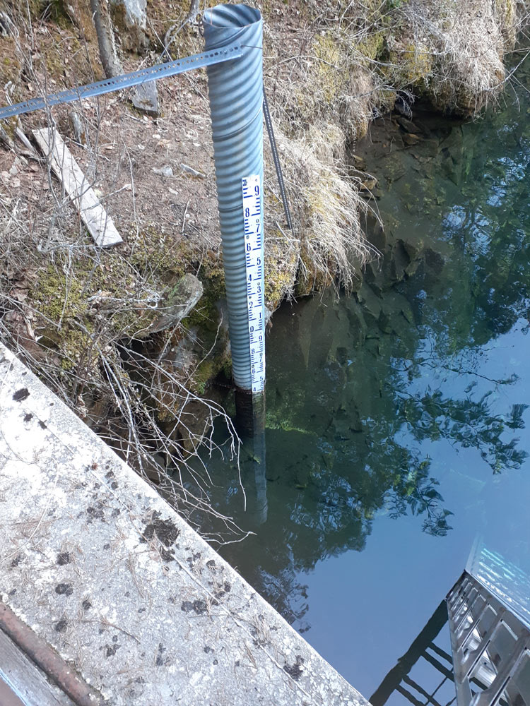
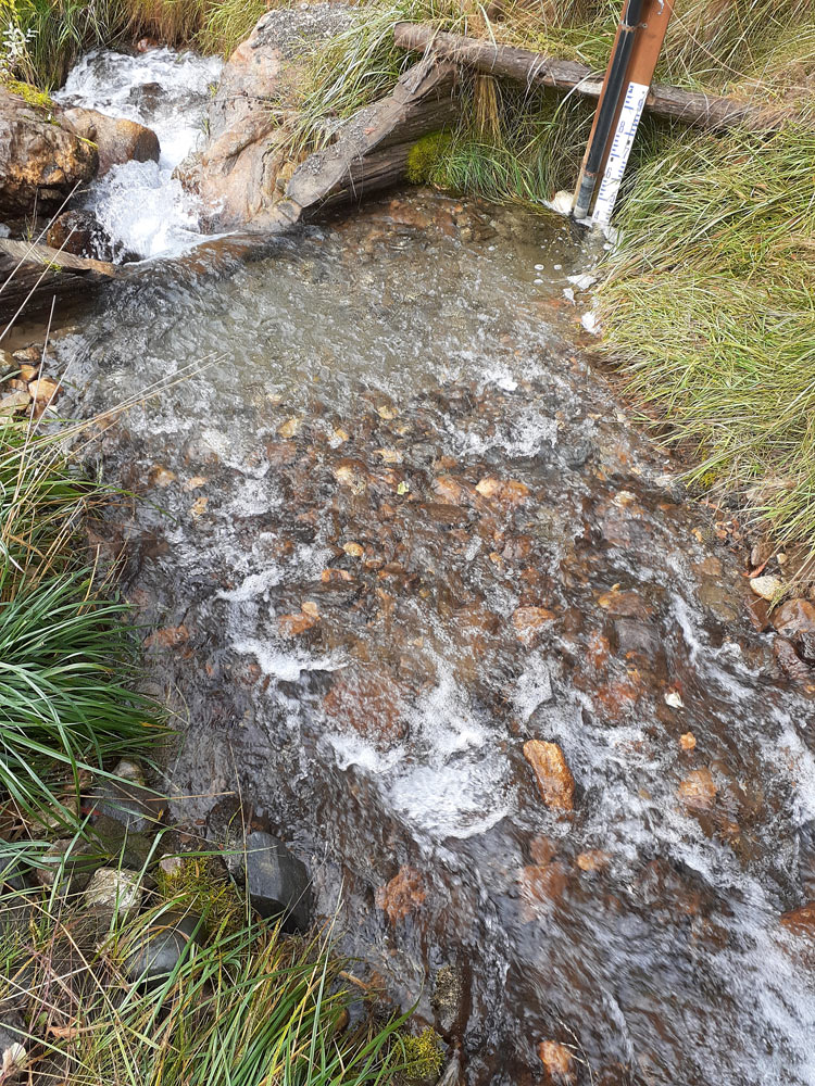
The Leveloggers are set to log water level and temperature every 15 minutes, providing a detailed record of water level fluctuations. The frequency allows them to download the data just twice a year.
Paul Saso, Hydrologist with Kootenay Watershed Science, says the original decision to go with Solinst Leveloggers was based on reputation, good accuracy, reasonable price, and reliability. “They have a great reputation and have definitely lived up to it” Paul noted.
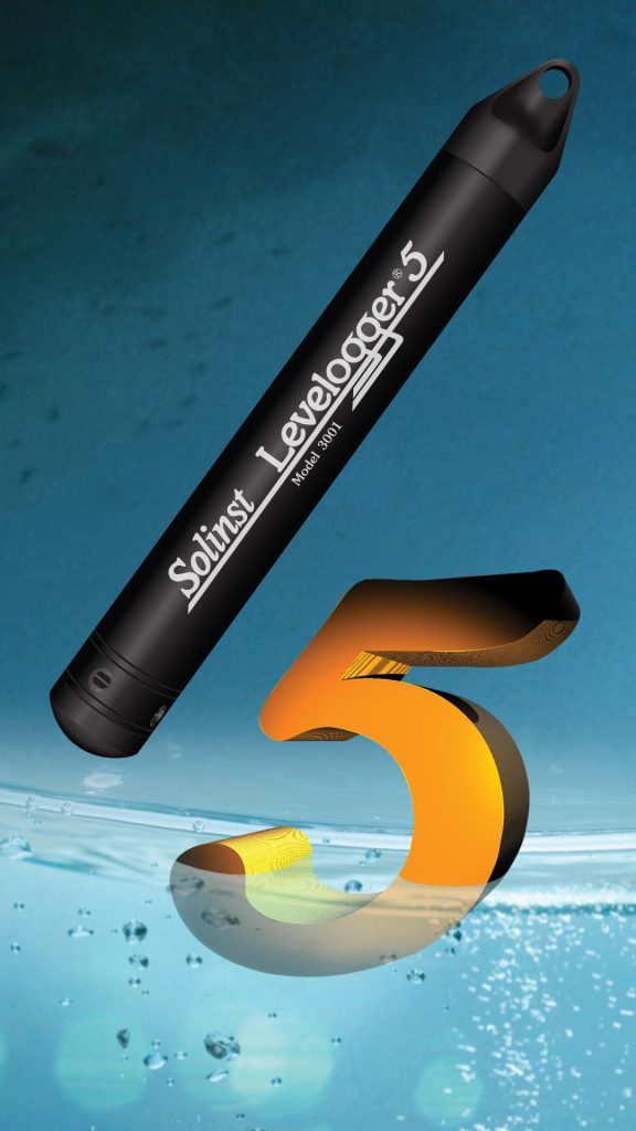
The Model 3001 Levelogger 5 is an accurate water level and temperature datalogger that provides a compact method of recording uninterrupted, long-term data. The Levelogger 5 consists of an absolute pressure sensor, temperature thermistor, datalogger and 10-year lithium battery, in a stainless steel housing with a PFAS-free corrosion-resistant coating inside and out. A memory for 150,000 sets of readings allows higher-resolution data with more frequent readings. Accuracy is 0.05% FS.
Get a Quote!
Solinst recently donated seven Leveloggers and Barologgers to replace the dataloggers that have been recording for almost 10 years. The plan is to deploy the additional datalogger in a high alpine lake as part of a high alpine lake monitoring pilot project.
The Levelogger water level data (stage data) is used to calculate discharge in the streams. Water level data is converted to discharge (streamflow) by determining the relationship between stage and discharge, using streamflow measured at a number of different stages through time to create the Stage Discharge rating curve.
The air temperature data from the Barologgers are stored. They may be able to provide information towards future modelling work for low-elevation areas around the hydrometric stations.
Data Storage and Sharing
The data collected by KWS is made available on the Columbia Basin Water Hub, which provides quality-controlled water-related data via an open-source database developed and formally launched in 2021 by Living Lakes Canada. The Columbia Basin Water Hub can be accessed here: https://data.cbwaterhub.ca/
KWS also has a partnership with Aquatic Informatics for processing, storing, and distributing data online. Data can be accessed and viewed on their Webportal: https://mission.aquaticinformatics.net/AQWebPortal/
Kootenay communities rely on small streams for drinking water, agriculture and other purposes. The streams also provide important aquatic and riparian habitat. As such, it is imperative to protect these resources.
The data collected will ultimately help evaluate how the watersheds in the region will respond to different hydrological flows– especially in times of high precipitation and low water supply. The data will help predict the risk, frequency and outcome of more catastrophic events brought on by climate change, such as flooding and landslides.
Making the data available to decision-makers will allow for appropriate water budgeting and watershed management into the future, ensuring communities are supported and ecosystems remain functioning.
For more information on Kootenay Watershed Science, visit: https://livinglakescanada.ca/project/kootenay-watershed-science/
Or follow them on Facebook: https://www.facebook.com/Kootenay-Watershed-Science-107940540747737/
Solinst thanks Paul Saso, Hydrologist with Kootenay Watershed Science, for providing the details of this project.