Restoring Coastal California Wetlands
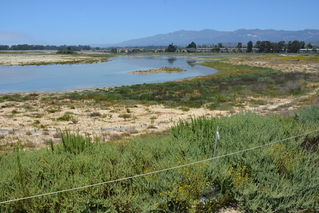
Over 90 per cent of historical coastal wetlands in South Central California have been lost due to development. One such area is the former upper arms of the Devereux Slough, located just northwest of the University of California, Santa Barbara (UCSB) main campus.
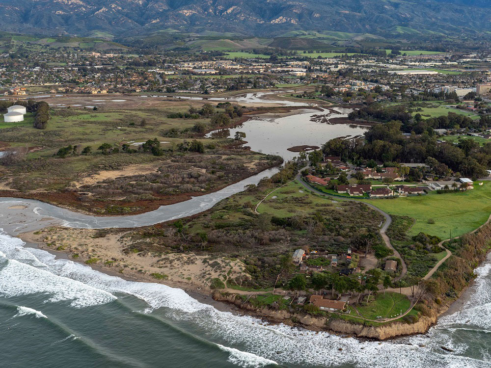
In the 1960s, the wetland was filled to create a golf course. The soil added to the site altered the essential drainage functions of the slough and reduced water holding capacity, resulting in regular flooding. Persistent flooding contributed to the challenges of managing the golf course. Eventually, the landowners sold most of their property. The Trust for Public Land purchased the area and donated it to UCSB in 2013.
The Cheadle Center for Biodiversity and Ecological Restoration (CCBER) took the lead in a project to restore 40 acres of wetlands to their natural state. With help from several partners and the local community, CCBER gained funding through grants to conduct preliminary studies and develop a restoration plan. The plan was ultimately approved, and wetland reconstruction commenced in April 2017.
The North Campus Open Space Restoration Project
Officially named The North Campus Open Space Restoration Project (NCOS), the entire undertaking comprises 100 acres of land. In addition to estuarine, palustrine and vernal wetland redevelopment, areas of grassland and scrub are being re-established. The main project goals are:
- Flood mitigation for the surrounding community
- Habitat restoration and support for threatened and endangered species
- Public access to recreational trails and educational opportunities
Benefits from the restoration include improved water quality, carbon sequestration, and the preservation of species diversity. The project design also integrates measures to adapt to sea level rise.
Water Level Data Collection Using Solinst Leveloggers
CCBER has been using Solinst Leveloggers throughout much of the planning and restoration process. They are used to monitor hydrology and salinity of the surface water and groundwater at the site.
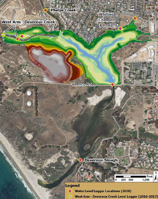
According to Ryan Clark, the Monitoring Coordinator at CCBER, Leveloggers were initially deployed to monitor water levels in key tributaries and the main creek that flowed through the former golf course. In 2015 through 2016, more Leveloggers were added to collect baseline data before restoration began in 2017.
Currently, the Leveloggers are installed to monitor surface water levels in the creeks and stormwater outflows that feed the upper Devereux Slough. Leveloggers are also measuring surface water levels within the slough and in a couple of freshwater ponds near the wetland. Most recently, LTC Leveloggers were added to begin monitoring conductivity, along with the water levels.
The Model 3001 Levelogger 5 LTC continuously measures and logs water level fluctuations, temperature and conductivity. The Levelogger 5 LTC has an 8-year battery life, memory for 100,000 sets of readings, and 6 pressure ranges. A PFAS-free coating baked on using polymerization technology (inside and out) provides superior corrosion and abrasion resistance. Compatible with all Levelogger 5 accessories including Solinst Telemetry Systems.
Get a Quote!
As of November 2019, five LT Leveloggers (level & temperature), four LTC Leveloggers (level, temperature & conductivity) and one Barologger (for barometric compensation of water levels) are collecting data.
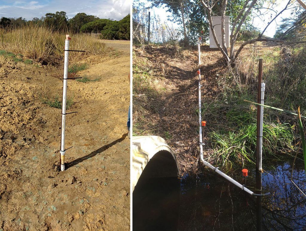
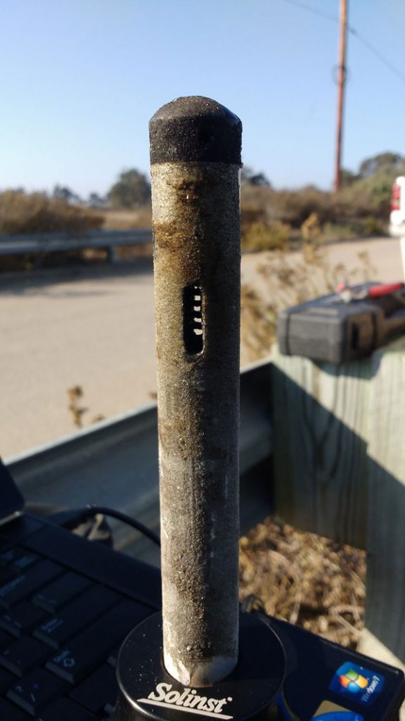
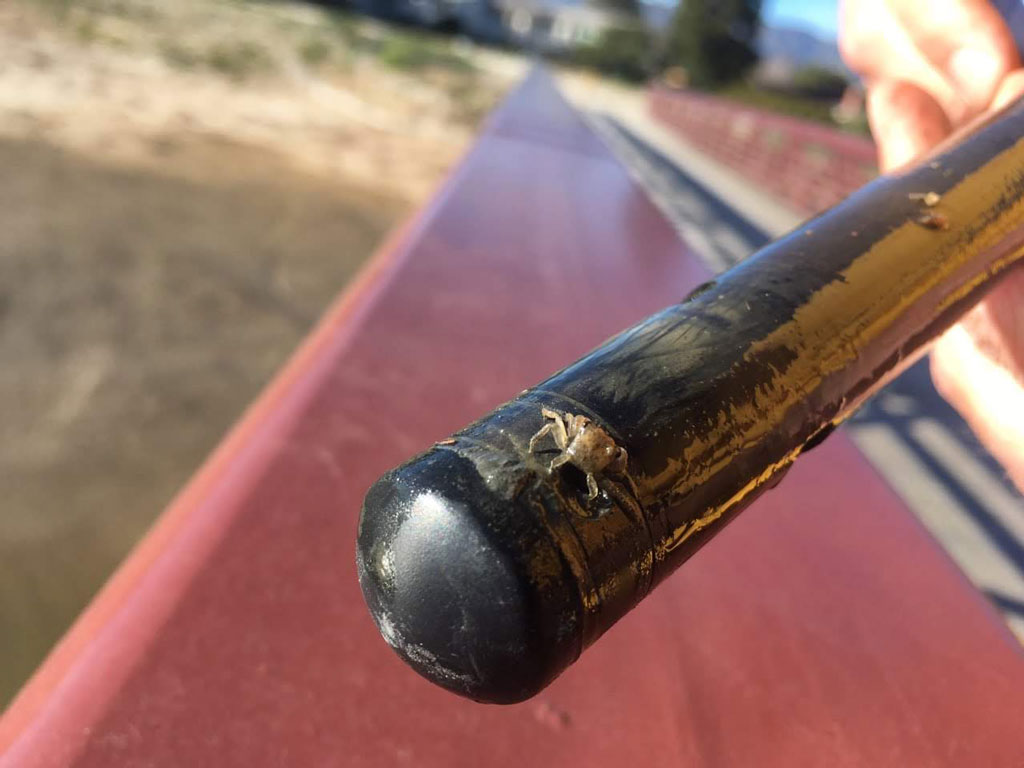
Ryan explains that all Leveloggers are deployed on wireline within a PVC housing, or well. The wireline is either attached to a top cap or anchored to the same structure as the housing. The PVC housing/well has several holes or vents near the bottom, where the Levelogger is suspended or sits.

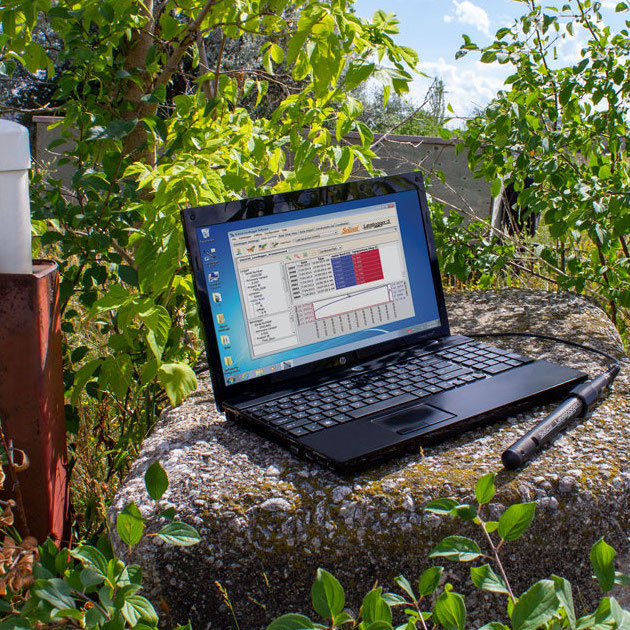
The Leveloggers are typically set to record every 15 minutes. Data is downloaded using an Optical Reader and laptop every 3 to 4 months, or more frequently depending on any storm events of interest.
Water level data (uncompensated and compensated files) are saved on local and cloud-based servers. The data is available to all CCBER staff, UCSB students, faculty and affiliates. They are working to make the data open to the general public.
The Importance of Water Level & Quality Data in Wetland Restoration
Water Level Data to Assess Wetland Holding Capacity
CCBER is interested to see how wetland reconstruction alters water levels during stormwater flows at the NCOS site.
Leveloggers help determine the elevation of water reached during storms. The known elevation of the Leveloggers is used to convert their water level readings to elevation (in feet NAVD88). Staff gauges set to elevation instead of absolute depth are used to crosscheck the data.
Water level data from similarly sized precipitation events, pre and post-restoration, are compared to determine the effect on flood levels. For example, the charts below show that the maximum water elevation recorded in Phelps Creek post-restoration is lower—just over 13 feet in 2018 versus over 17 feet in 2017.
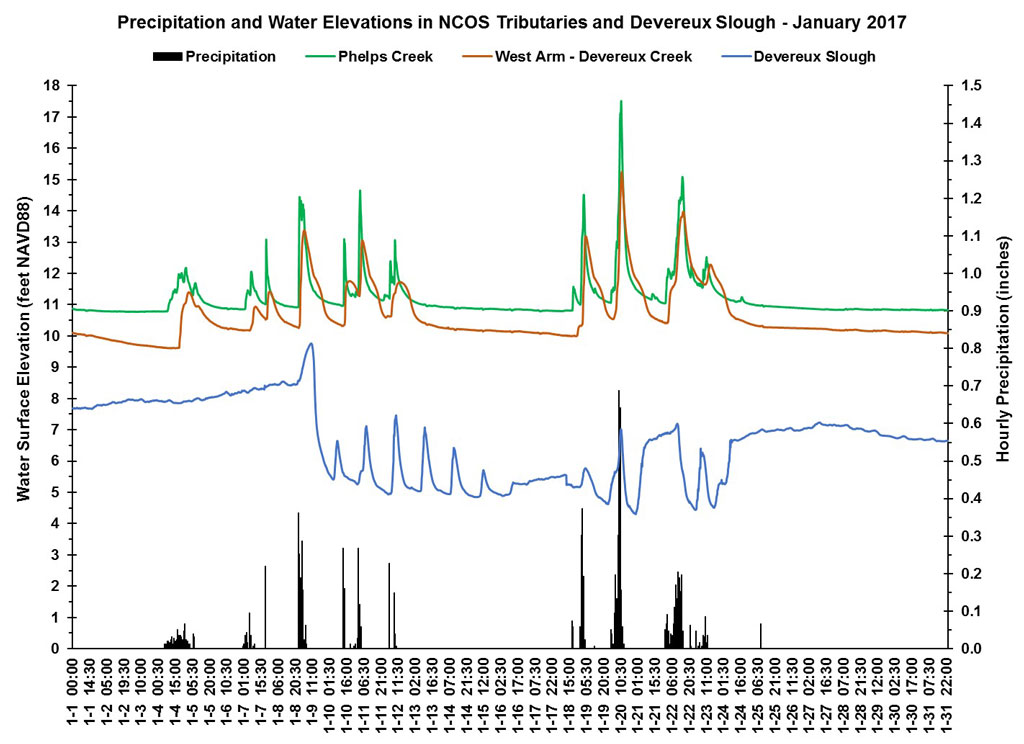
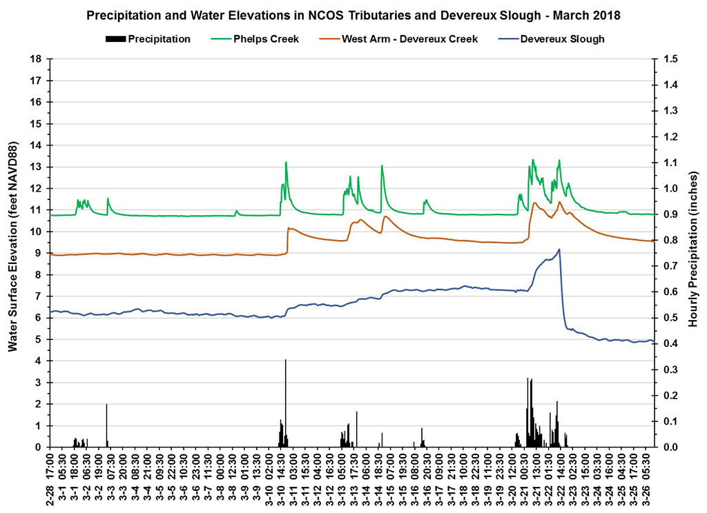
The results indicate that the methods to increase wetland capacity through expansion have so far been successful in reducing flood levels and supporting groundwater recharge.
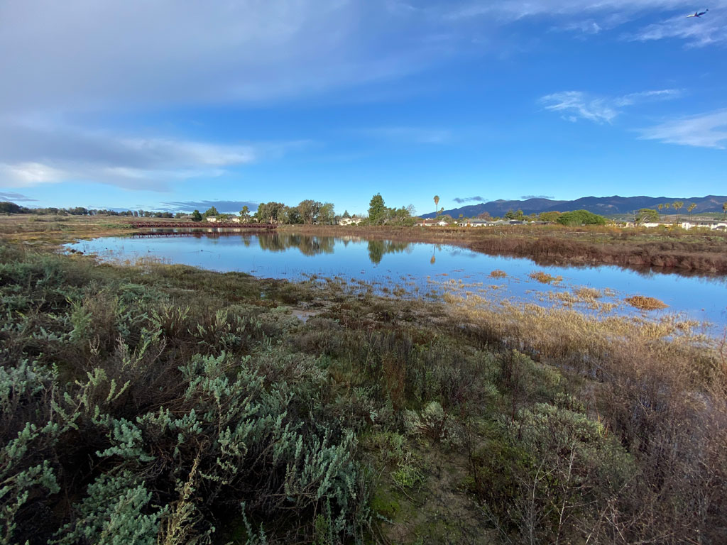
In addition to stormwater flows, CCBER is monitoring how water levels fluctuate when the slough is connected to and receives tidal surge from the sea.
The Devereux Slough is intermittently tidal, meaning a sandbar separates it from the sea except for a few times each year when it is briefly breached due to high tides, wave action, and rainfall levels.
Recent results from monitoring water levels and precipitation show that more rainfall is required before the sandbar is breached—another sign that restoration measures are having a positive effect on wetland storage capacity.
Water Level & Quality Monitoring Helps Reestablish Native Plants
Another major part of the restoration is the re-establishment of native plant species. Many wetland plants are sensitive to changes in the water salinity and water balance in their ecosystem. As such, it is vital to monitor and maintain ideal growing conditions.
A Solinst LTC Levelogger is installed in a groundwater well to monitor water levels and conductivity near a population of an endangered plant, the Ventura Marsh Milk-vetch (Astragalus pycnostachys var lanosissimus), being reintroduced. This species is especially sensitive to groundwater depth and salinity.
Assessing & Ensuring the Success of Wetland Restoration
Water level and quality data provide insight on the impacts, and ultimately the success of wetland restoration efforts. The data helps verify models and predictions made during planning and throughout the restoration process. Monitoring ensures restoration measures are on track, and the proper conditions are maintained for continued success.
Wetlands provide several valuable functions including flood control, water filtration, support high biodiversity and provide crucial habitat for flora and fauna. So far, the data collected by CCBER is showing positive results in all of these critical areas for the NCOS project.
For regular updates on the restoration, visit: https://www.ccber.ucsb.edu
Thanks to Ryan Clark, Monitoring Coordinator with CCBER, for providing the details on this project, and photos credited to Ryan, Eirik de Wit, and Jeremiah Bender.