Stormwater monitoring is ever increasing in importance. With continued development and urbanization, comes the loss of green space—space that once absorbed stormwater runoff. These areas are replaced by impervious surfaces such as roads, rooftops, and parking lots.
Altering land-use leads to considerable changes in the natural drainage pattern. Stormwater management creates a new pattern designed to handle the impacts.
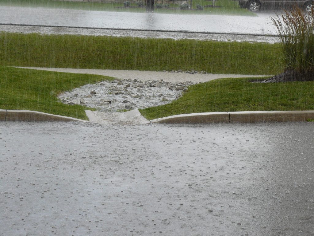
Increased Impervious Surfaces Mean Increased Stormwater Runoff
Stormwater controls aim to reduce peak flows, flooding, erosion, and effects on receiving waters. This is accomplished by diverting, slowing and storing stormwater runoff.
The goals are to increase infiltration, evaporation, and filtration of stormwater. In order to achieve these goals, monitoring stormwater controls is key.
Water Level Dataloggers & Stormwater Monitoring
Water level dataloggers, such as the Solinst LevelVent, AquaVent, or Levelogger, can be simple tools to help evaluate the effectiveness, track performance, and maintain the integrity of certain stormwater control methods.
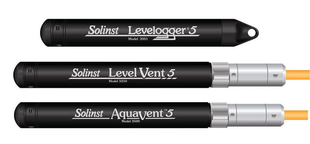
Solinst Levelogger, LevelVent and AquaVent Water Level Dataloggers
Solinst water level dataloggers provide an all-in-one solution, combining a pressure transducer, temperature sensor, and datalogger in watertight, rugged housings. Their weather-resistant material provides protection against the elements and ensures performance when deployed underwater for extended periods.
Solinst water level dataloggers are compact and have flexible deployment options. They are easy to install in surface water or groundwater monitoring applications.
As stormwater monitoring applications tend to be shallow installations, Solinst recommends using the LevelVent or AquaVent vented water level datalogger. The LevelVent and AquaVent provide highly accurate water level fluctuation data, especially in shallow conditions.
However, for certain deployments, it may be easier to use the Solinst Levelogger. Check out our blog post that reviews the differences between the Solinst LevelVent, AquaVent, and Levelogger water level dataloggers, to see which one suits your specific application: https://www.solinst.com/onthelevel-news/2016/07/absolute-vs-vented/
Monitoring Stormwater Basins
Stormwater basins are very common methods of stormwater management. Basins collect stormwater and release it more slowly into receiving waters or conveyance structures.
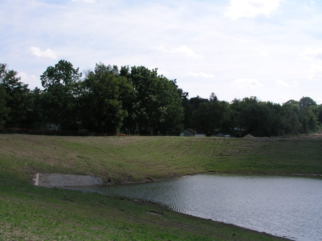
Stormwater Basins Collect Runoff and Release it More Slowly into Receiving Waters
Stormwater basins typically receive stormwater runoff through multiple inlets such as pipes, trenches, ditches, and swales. Detention basins collect runoff and release it slowly, while retention basins capture runoff and store it so water infiltrates into the soil.
When installed in stormwater basins, water level dataloggers monitor inflows, outflows, stormwater storage capacity, as well as stormwater overflows. Water levels track the flow of stormwater into and out of detention/retention structures.
Rainfall data from the same monitoring period tells you how much rainfall creates changes in water levels in the basin, and leads to higher flow rates and overflows.
Note: Solinst offers the Rainlogger 5 rainfall datalogger. The Rainlogger 5 connects to a tipping-bucket rain gauge. It records each tip by the tipping-bucket and outputs the amount of rainfall per tip. View data in Solinst Levelogger Software, or output it for use in other programs.
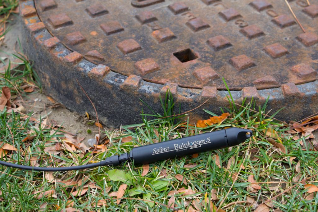
The Solinst Rainlogger 5 Rainfall Datalogger Connects to a Tipping- Bucket Rain Gauge
Water level dataloggers are a convenient way to assess the performance of a stormwater basin. Water level dataloggers track the number of stormwater basin overflows.
Changes in water levels also suggest that infiltration is occurring in a retention basin, and provide an idea of the infiltration rate.
When overflows occur too frequently and infiltration rates are lower than expected, the need for improvements is realized. After implementing improvements, water level dataloggers are a great way to monitor and compare the results.
Continuous water level monitoring in stormwater basins provides an advance warning or indication of clogs in the system. Signs that infiltration rates are slowing can imply that the basin is in need of maintenance.
Note: Solinst dataloggers combined with telemetry systems, for long-term remote monitoring, allows email alarms to indicate an unexpected change in water level or an overflow.
Measuring Stormwater Infiltration
Where traditional management strategies include re-directing the stormwater off-site, retaining it elsewhere, or simply diverting it directly into receiving waters, today more focus is put toward treating the problem on-site.
Practices promote infiltration, over controlling runoff. The common trend is to integrate stormwater management plans directly into new urban designs (low impact developments (LID)), with the aim to increase groundwater recharge in place, before becoming runoff.
Commonly, stormwater best management practices (BMPs) use vegetative controls, such as grass swales, vegetative filter strips, rain gardens and increase permeable surfaces using porous pavements and graveled areas.
Note: wetlands are another option for stormwater management. They not only control runoff quantity but also provide a control for water quality. Here’s a case study where Solinst Leveloggers are used to evaluate the performance of constructed wetlands: https://www.solinst.com/onthelevel-news/water-level-monitoring/water-level-datalogging/levelogger-proves-ecohydrological-research/
With these stormwater management practices, water level data loggers are useful when deployed in groundwater monitoring wells. Groundwater level fluctuations are observed, and infiltration rates estimated as a result of these practices.
As with monitoring water levels in stormwater basins, monitoring water levels in wells can help determine the effectiveness of the stormwater control measure.
Note: green roofs are also becoming a more popular on-site stormwater control. Water level dataloggers can also be used here to evaluate and monitor the ability of a green roof to store water.
Stormwater Conveyance Structures
In addition to providing raw water level data, water level dataloggers can be used to calculate flow volume. This can eliminate the need to purchase more expensive flow meters.
Weirs and flumes are traditional methods for controlling and measuring the flow rate of stormwater runoff. These specifically shaped, engineered structures establish a relationship between the depth of the water moving through an open channel and the rate at which it is flowing.
Water level data indicates the depth of water flowing through the structure; therefore flow rates are calculated.
Weirs and flumes are great to monitor flow rates upstream and downstream of a control measure. Monitoring flow rates help determine the success of a control, and decide if further management options need to be put in place, or improved.
Here’s a case study where Leveloggers are used to monitor flow in flumes in Peru: https://www.solinst.com/onthelevel-news/water-level-monitoring/water-level-datalogging/leveloggers-monitor-irrigation-channels-in-peru/
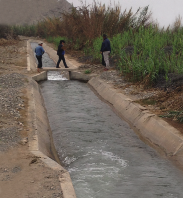
Leveloggers Monitor Water Levels in Flumes in Peru
Stormwater Management
Stormwater management is not only a good idea it’s a requirement. In most cases, municipalities and conservation authorities are responsible for urban water management, but it is also the responsibility of new developers to manage stormwater through construction to the final design of the site.
With new developments popping-up at high rates, aging infrastructure requiring upgrades, and the concerns of changing weather patterns and frequency/length of storms with climate change, implementing stormwater management is only increasing in importance.
But Stormwater management is expensive, and with lack of funding in many areas, simple, inexpensive monitoring options such as water level dataloggers can be an advantage.
Whether tracking changes in storage, estimating infiltration rates, or for use in flow calculations, water level data revels the performance of a stormwater control, where improvements and maintenance are needed, and determines if further monitoring is a good idea.
Here are a few examples of studies that employed water level dataloggers to help evaluate the performance of various stormwater control measures:
Kelly, Daniel. 2014. Data show rain garden benefits on flood-prone Marietta College campus creek. The Environmental Monitor. Fondriest Environmental, June 10, 2014. Available [online]: https://www.fondriest.com/news/data-show-rain-garden-benefits-flood-prone-marietta-college-campus-creek.htm
Lenhart, C., Gordon, B., Gamble, J., Current, D., Ross, N., Herring, L., Nieber, J. and Peterson, H. 2016. Design and hydrologic performance of a tile drainage treatment wetland in Minnesota, USA. Water (Switzerland), 8(12), [549]. DOI: 10.3390/w8120549
Steffen, Jennifer R. 2012. Bioretention Hydrologic Performance in a Semiarid Climate (Masters Thesis). University of Utah, 63 pages; 1530947. Available [online]: https://cdmbuntu.lib.utah.edu/utils/getfile/collection/etd3/id/2043/filename/2060.pdf. The
Sychterz, Ann, Tim Schill and Brian Verspagen. 2014. Monitoring Performance of Low Impact Development Measures Implemented at the Conestoga College South Campus. Journal of Water Management Modeling. C371 DOI: 10.14796/JWMM.C371
Talebi, L. and R.E. Pitt. 2014. Evaluation and Demonstration of Stormwater Dry Wells and Cisterns in Millburn Township, New Jersey. Journal of Water Management Modeling C376. DOI: 10.14796/JWMM.C376.
A note on stormwater quality monitoring:
Stormwater monitoring not only includes water quantity but also impacts on water quality. The Solinst AquaVent, LevelVent, and all Leveloggers record water temperature along with level data. Changes in temperature are a great indication of a stormwater input (stormwater runoff is usually higher in temperature due to the warmer surfaces it flows over).
In addition, the Solinst Levelogger 5 LTC has the added advantage of conductivity measurement. Conductivity is a great indicator of changes in water quality. Monitoring these parameters is a simple, cost-effective way to monitor the changes in water quality due to stormwater runoff.
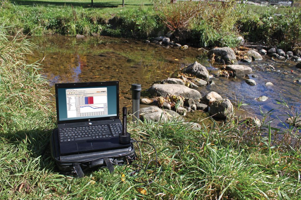
For more information on Solinst LevelVent, AquaVent and Levelogger water level dataloggers, contact one of our technical sales representatives, and they will be happy to discuss your stormwater monitoring applications.
References:
Ontario Ministry of the Environment. 2003. Stormwater Management Planning and Design Manual. Queen’s Printer. Toronto, ON.
Credit Valley Conservation and Toronto and Region Conservation Authority. 2010. The Low Impact Development Stormwater Management Planning and Design Guide. Version 1.0. Toronto, ON.
Credit Valley Conservation. 2011. Study Report: Thermal Impacts of Urbanization including Preventative and Mitigation Techniques. 162 p.
