| Download Technical Bulletin |
Leveloggers are used for measuring water levels in various surface water monitoring applications, including:
- flood and drought monitoring,
- base flow monitoring in stream beds,
- watershed recharge studies,
- stream gauging,
- lake and reservoir level monitoring,
- harbour and tidal fluctuation monitoring,
- wetlands monitoring,
- stormwater runoff monitoring,
- construction site runoff management,
- ecological studies, field research and more.
When selecting the proper Levelogger for surface water monitoring, careful consideration is required. For installation within rivers, streams, wetlands, and lakes, the shallow pressure range (M5) Levelogger 5 or Levelogger 5 Junior should be considered. These instruments are ideally suited for shallow surface water applications, where precise water level measurements are essential.
The M5 Levelogger 5 or Levelogger 5 Junior instruments use highly sensitive pressure sensors for precise water level accuracy and resolution. The Levelogger 5 M5 range is designed for 5 meters or 15 feet submergence, and can attain typical water level accuracies of ±3 mm (0.01 ft). This allows subtle variation in water levels to be recorded with high accuracy.
In coastal applications, such as flood and storm surge monitoring, it is important to use instruments that are more resistant to corrosion and biofouling, as well as able to handle larger fluctuations in level (tidal, storms), such as the Levelogger 5 M20. For added protection, a Biofoul Screen is available for use in coastal environments.

Levelogger 5 and Levelogger 5 Junior instruments provide accurate water level and temperature datalogging in surface water monitoring applications.
Surface Water Monitoring Installation Methods

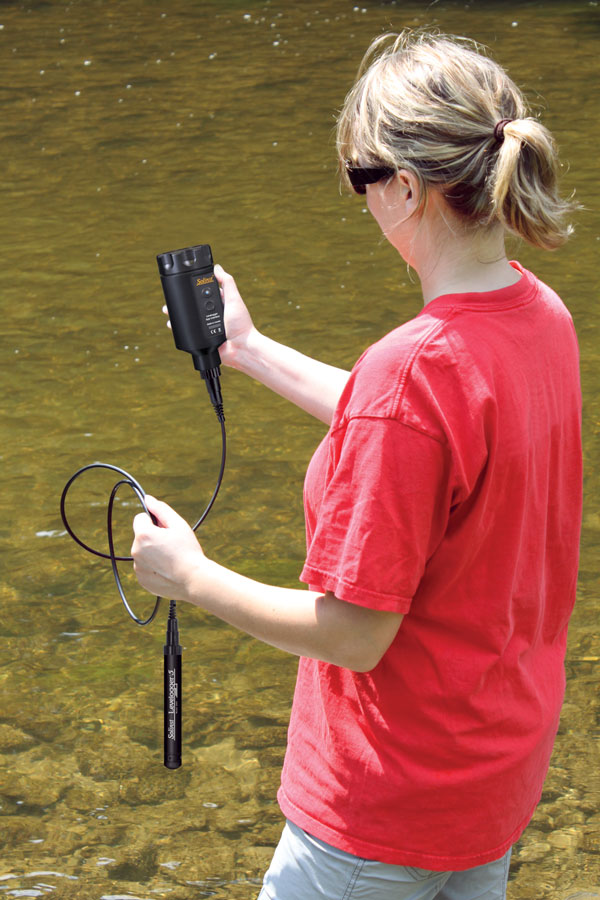
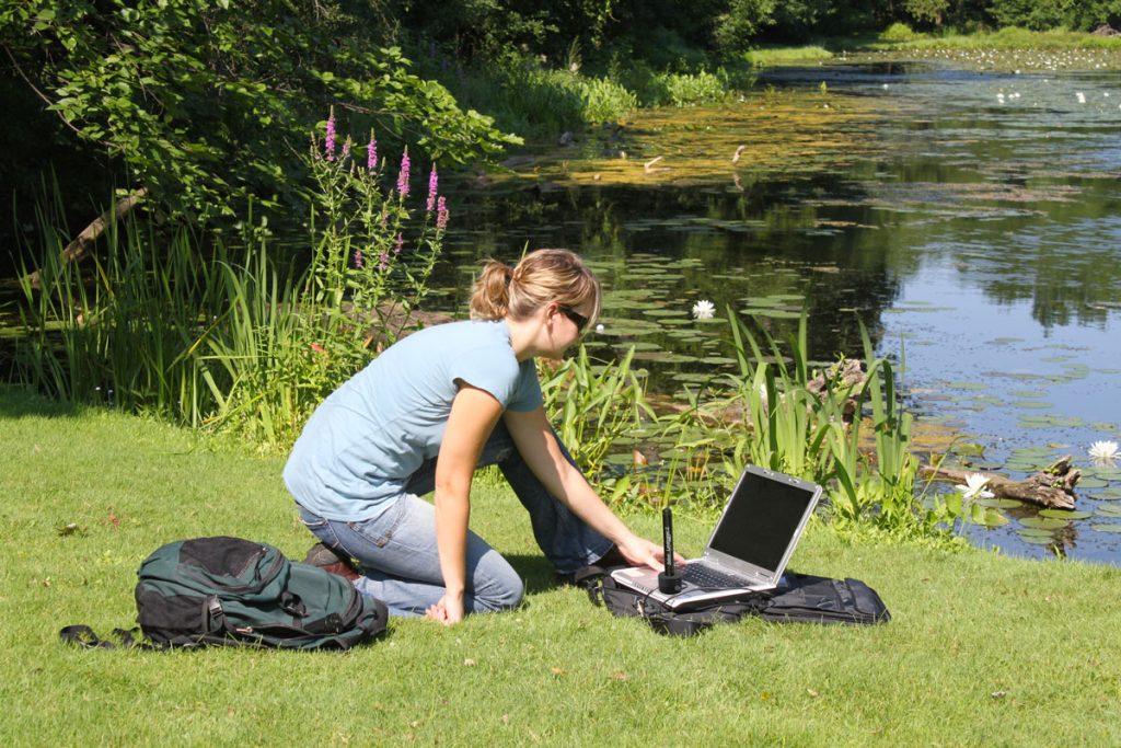
A Levelogger 5 App Interface is being used to communicate with the Levelogger in the field.
The following section has been adapted from Measuring Stream Temperature Using Dataloggers: Laboratory and Field Techniques by the Ontario Ministry of Natural Resources, Aquatic Research and Development Section.
Before installing your Leveloggers, it is important to observe your surroundings, as well as the water body’s characteristics.
If your application is in a public area that is regularly visited (for fishing, boating, etc.), you need to consider concealing your application so it is not tampered with. It is best to use natural rocks or debris to hide installations where possible, but remember to ensure you do not to impede water flow to the Levelogger sensor.
You should determine if access to the site might be a problem in the future. Avoid installing in rapid moving water, near an unstable bank, or an area that could become too deep to access. It is ideal to install during a dry, low flow period, for safety, as well as to ensure you have installed to a sufficient depth so that the Levelogger is always submerged. In streams and rivers, it is necessary to base your installation method on the stream characteristics. The depth, stream load, flow velocity and substrate, are all factors. To avoid damage, remember to protect your datalogger from ice.

Programming a Levelogger in the Field for Surface Water Monitoring
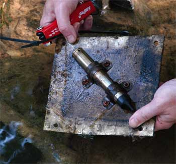
A “staked” installation is ideal for turbid streams, dynamic alluvial, and soft organic or silty stream beds. A simple staked installation uses a solid rebar or steel rod (12-24″ x 3/8-3/4″) with a small hole at the top end. The hole is used to thread a short cable tie or suitable wire/rope to attach the Levelogger, as well as a tag or marker to the rod. The rod is hammered into the substrate until only about 2-4″ of it is exposed.
A “free-weight” installation is best for slower moving streams with lower turbidity, bedrock dominated stream bed, or in a stream with a softer organic or silty stream bed. A free-weight installation may consist of a cinder block with a Levelogger secured to the inside of the block using a cable tie or metal straps. The cinder block is placed securely, directly in the stream.
In turbid conditions, the free-weight method is not recommended, as it will not be as easy to locate the block. A “tethered” method works well in turbid conditions, as it makes it easier to retrieve your Levelogger. Tethered installations are also a good method to use in areas where there are steep banks, or streams with deeper and more rapid rises and falls in water level.
A basic tethered installation can consist of a half cinder block with the Levelogger secured to the inside of the hole. An appropriate length of strong wire rope is attached around the cinder block, the other end is attached to a steel rod or rebar with a hole in one end.
The cinder block is placed carefully into the stream while holding the steel rod. Once the cinder block has settled on the bottom of the stream, the rod is hammered into the streambed until it is flush. A rock can be placed on the steel rod to keep it hidden.
Other Surface Water Monitoring Recommendations
Stilling wells are also a highly recommended method for direct installation in streams or rivers. Stilling wells can be constructed to shield the instrument from turbulent water. In shallow water bodies where icing/freezing may penetrate to the bottom, the Levelogger can be installed in a vented stilling well imbedded into the bottom of the water body beyond the frost line.

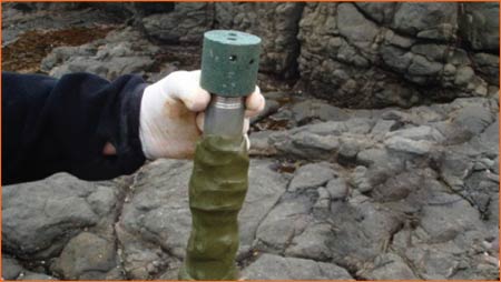
Leveloggers can be installed in protective pipes and secured to permanent fixtures, or directly in drilled holes in natural rock.
For coastal or deeper applications, Leveloggers can be placed in a protective pipe or casing and then attached to a permanent fixture such as a bridge, pier, etc., or a hand driven marker/rod in a pond or lake. There have also been cases where the protective pipes have been placed in drilled holes directly in natural rock.
Note: Levelogger Software allows Manual Data Adjustments using the software’s Data Compensation Wizard. After data collection, this allows you to enter a manual field measurement as a field zero, such as a depth to water level measurement using a water level meter, or a staff gauge, so that all of your Levelogger readings (height of water above the sensor) can be converted to height above sea level measurements, which is typical in many surface water studies.
Reference
Jones, N.E. and L. Allin. 2010. Measuring Stream Temperature Using Data Loggers: Laboratory and Field Techniques. Ontario Ministry of Natural Resources, Aquatic Research and Development Section, OMNR Trent University, Peterborough, Ontario. 28 pp.

