Irrigated agriculture in Peru has been an important part of the country’s growth and development, dating back before the Incan Empire. Recently, concerns including water stress, declining water quality, and vulnerability to climate change have induced a push from the Peruvian government to improve the performance of the existing irrigation systems.
The National Water Authority (Autoridad Nacional del Agua, ANA) is responsible for designing and implementing sustainable irrigation practices nationally. They work with local Water Users Boards who operate and maintain the irrigation systems regionally.
The ANA has an objective of accurately calculating the average amount (volume) of water used by each of the Boards. This data will allow them to track and determine the ideal amount of water to allocate to each Board and the agricultural users in that region.
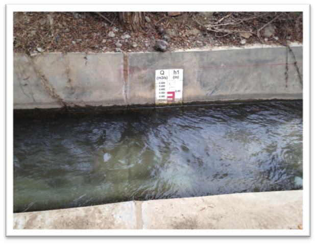
Flow is monitored, and volume is calculated using flumes in the irrigation channels. Flumes are fixed shaped hydraulic structures that create a relationship between water velocity and level in the channel. Generally, flow is measured by calculating the velocity of water through the area of the flume. As flumes are a set width, height of water (head) is required to calculate the area, thus flow.
Flumes in the irrigation channels are used to determine volume.
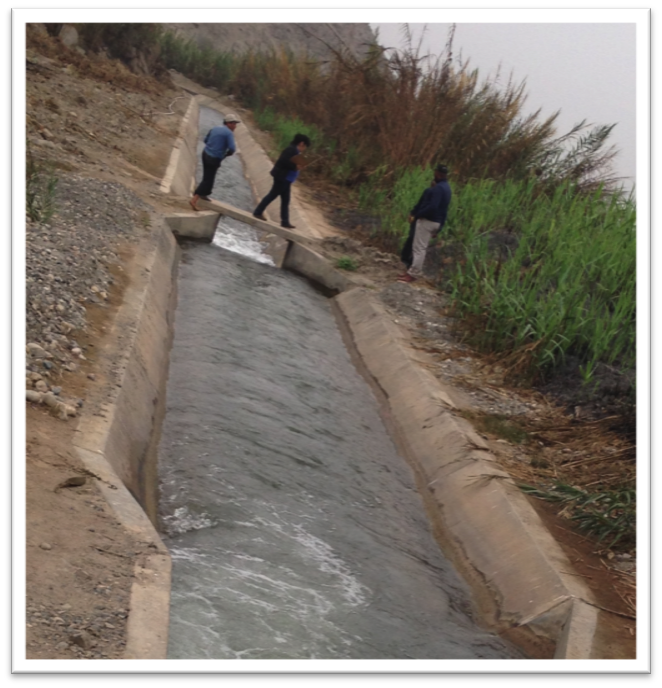
Traditionally, the height of water is determined by manually reading the level from visual markings on the side of the flumes. These readings have low accuracy and provide low-resolution data, as the levels are only recorded periodically.
Manual method of determining height of water in the irrigation channels.
High Tech Service, exclusive distributor of Solinst products in Peru, installs, calibrates, and repairs environmental monitoring instruments for projects throughout the country. High Tech Service started working with the Peruvian government in October 2014, to help provide a more efficient way to collect high-resolution data from the flumes.
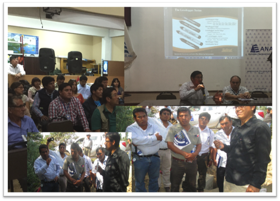
High Tech Service was involved in many meetings leading up to the project.
After several meetings with stakeholders, the ANA, and Water Users Boards, High Tech Service was given the assignment of installing Solinst Levelogger water level dataloggers to measure the height of water in each of the flumes.
Once installed, Leveloggers can be left unattended to automatically record and store continuous water level measurements. As a result, the costs to send out personnel for manual data collection are reduced, while the amount of reliable data recorded is increased.
To protect the Leveloggers (and associated Barologgers for barometric compensation of the water level data), concrete structures to house the instruments were built next to the flumes. A total of 148 monitoring stations have been installed in 6 different regions of Peru; 3 in Tumbes, 47 in Piura, 38 in Lambayaque, 27 in Huaral, 25 in Arequipa, and 8 in Tacna.
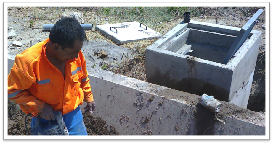
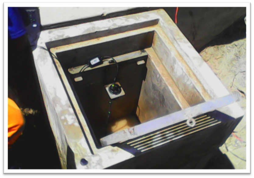
Concrete structures were built to protect the Leveloggers and Barologgers.
The Leveloggers and Barologgers have been set to record at either 5 or 10 minute intervals. The water level and barometric data are regularly downloaded in the field using a laptop and Levelogger PC Software. To optimize efficiency, if future budget allows, High Tech Service is hoping to use telemetry to remotely send the measurements to a central database.
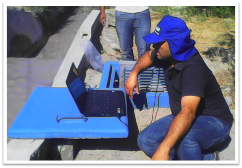
Water level data is downloaded in the field using a laptop and Levelogger PC Software.
Currently, the Levelogger data is being used to determine flow (volume) with greater accuracy than previous practices. The data will allow allocation of an exact volume of water to each user, and help to effectively control irrigated water usage throughout the country.
Solinst thanks Jesus Lino Ayala, Manager of Operations at High Tech Service S.A.C, for providing the details of this project.