| Download Newsletter | Download Presentation |
Between 1950 and 1970, an estimated 72,700 L of mixed Dense Non-Aqueous Phase Liquids (DNAPLs) were released into the subsurface at a site in southern Wisconsin. At the site, the DNAPL penetrated to 56 m below ground surface, accumulated in fractured sandstone, and formed a dissolved phase plume that migrated down gradient and stretched almost 3 km.
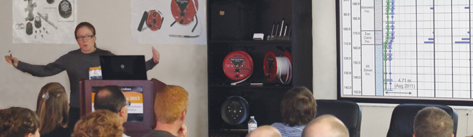
Jessica’s presentation focused on the field work that she has completed at the site. The goal of her research was to use a high-resolution method of measuring head at depth-discrete zones in order to calculate vertical gradients across the site. These vertical gradients were used to delineate hydrogeologic units in the subsurface.
Jessica used 9 multilevel systems with a number of discrete zones to obtain the high resolution head profiles. As an example, one multilevel system had 46 sampling zones in 129.5 meters of bedrock – approximately 3.6 zones for every 10 meters.
The head profiles were measured several times a year, over multiple years. Jessica showed profiles measured in 2003, 2009, and 2011. The results of each year showed the head profiles were similar and repeatable.
Jessica combined the measured vertical gradient zones with the known sequence stratigraphy in the area, and was able to delineate 8 hydrogeologic units.
Jessica then compared the hydrogeologic unit conceptual site model that was created, with the observed DNAPL distribution and high resolution rock core contaminant profiles. The comparison showed that the hydrogeologic units based on the vertical gradients and associated with the sequence stratigraphy, could clearly be related to the contaminant distribution.
This shows that the data collected will be critical in determining the fate of the contamination and help evaluate potential methods for remediation.
 ABOUT THE SPEAKER – Jessica R. Meyer, PhD
University of Guelph
Jessica R. Meyer recently received her Ph.D. from the School of Environmental Sciences at the University of Guelph and has degrees in environmental geology (B.Sc., University of Montana, 2002) and hydrogeology (M.Sc., University of Waterloo, 2005).
Between her MSc and PhD degrees, Jessica worked as a research associate at the University of Waterloo with Dr. Beth Parker and Dr. John Cherry where she helped to advanced high resolution field characterization methods, co-developed a customized relational database, and managed research activities at a contaminated sedimentary rock field site in Wisconsin (2005-2008).
Her research focuses on field based characterization of fractured sedimentary rock flow systems and aquitard hydrology using a combination of diverse methods including high resolution, depth- discrete hydraulic head and response data sets.