Coal mining began in Pennsylvania over 250 years ago, and today it still supplies 60 per cent of the fuel for the state’s electric power generation—the fourth largest coal-producing state in the U.S.
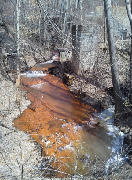
Despite efforts such as the Surface Mining Control and Reclamation Act (SMCRA, 1977), over 5000 miles of Pennsylvania’s streams remain polluted by abandoned mine drainage1.
1http://epcamr.org/storage/Abandoned_Mine_Land_Pgm_Fact_Sheet.pdf
In 1996, the Eastern Pennsylvania Coalition for Abandoned Mine Reclamation (EPCAMR) was established to facilitate the reclamation and remediation of land and water polluted by past mining practices.
EPCAMR is a not-for-profit organization that partners conservation districts with watershed organizations, mining and power generation companies, concerned citizens, and other affected stakeholders.
In general, EPCAMR aims to encourage land redevelopment by lessening health and safety hazards, reducing erosion, improving water quality, and returning land to a usable state, as such improving the economy in the region.
In addition to reclamation and restoration efforts, EPCAMR offers education and outreach to the public on mine drainage and reclamation issues and provides many volunteer opportunities; visit their website for more information: https://epcamr.org
Abandoned Mine Drainage
In 2018, EPCAMR began a new water monitoring project in Mocanaqua, Pennsylvania, at the lower tip of the Northern Anthracite Coal Field in the Pinchot State Forest. The monitoring site is an abandoned underground and surface coal mine operation called the West End Colliery.
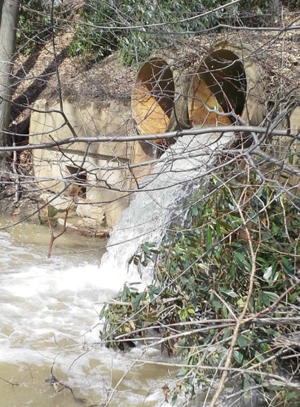
An on-site stream flows underground into the former coal mines and comes out as polluted mine drainage discharge. The acidic 3.7 pH water carries a concentration of 4 milligrams per litre of each heavy metal, iron and aluminium, which flows into the Susquehanna River at an average of 17 cubic feet per second.
The polluted stream discharge gained interest from the Susquehanna River Basin Commission (SRBC). The SRBC regulates withdrawals on the river for consumptive use. Consumptive use (CU) is water that is used in a way that it cannot be returned to the environment without some form of degradation to its quality or quantity. For example, the SRBC looks to mitigate water consumed by cooling towers at power plants or used to frack gas wells.
Projects or industries that cannot achieve their own mitigation or remediation of consumed water can pay a fee to provide make-up solutions on their behalf. That’s where SRBC’s interest in mine drainage comes into play.
The SRBC investigates options that may offer mitigation or make-up water for consumptive users in the river basin. This includes evaluating flooded underground mine pools for potential water storage and treatment before it gets discharged.
Controlling the amount of water being discharged from the mine pools, allows treatment, and then release when water levels are low. This provides clean water to the river basin that would have previously been left untreated.
Investigating Abandoned Mine Storage and Discharge
The water monitoring program stemmed from EPCAMRs 3D mine pooling mapping initiative: 3D Modeling of Eastern Pennsylvania Anthracite Mine Pools in Earthvision to Improve Water Quality Restoration and AMD Treatment Via Consumptive Use Mitigation Projects in the Susquehanna River Basin
EPCAMR develops three-dimensional mine pool models to help estimate water storage volumes. Furthering this initiative, EPCAMR teamed up with SRBC for a field investigation. The water monitoring project was funded by a Consumptive Use Mitigation Grant that EPCAMR received from SRBC.
Ten monitoring stations were set up to investigate surface water infiltration, flow, chemistry, and mine pool elevations in the Mocanaqua mine drainage rock tunnel and underground mine pool complexes.
The program employs Solinst Levelogger water level dataloggers. Ten Leveloggers and a Barologger (used to compensate Leveloggers for barometric pressure) are deployed at the Mocanaqua abandoned mine land area.
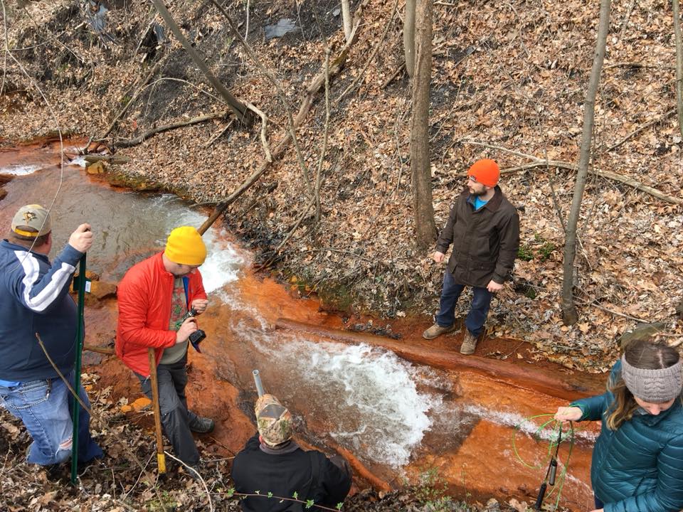
Leveloggers were selected as they allow simultaneous measurement of surface water levels and water levels in the mine pool boreholes (similar groundwater wells). The water level measurements help provide an understanding of water movement through the site and indications of where surface water losses occur.
Two Leveloggers are deployed to measure the water levels on the stream. Three Leveloggers measure water levels in mine strip pits that were believed to be tied to the mine pool. Four Leveloggers are installed in boreholes drilled into the mine pool. The last Levelogger measures water levels at the Mocanaqua collapsed mine tunnel discharge.
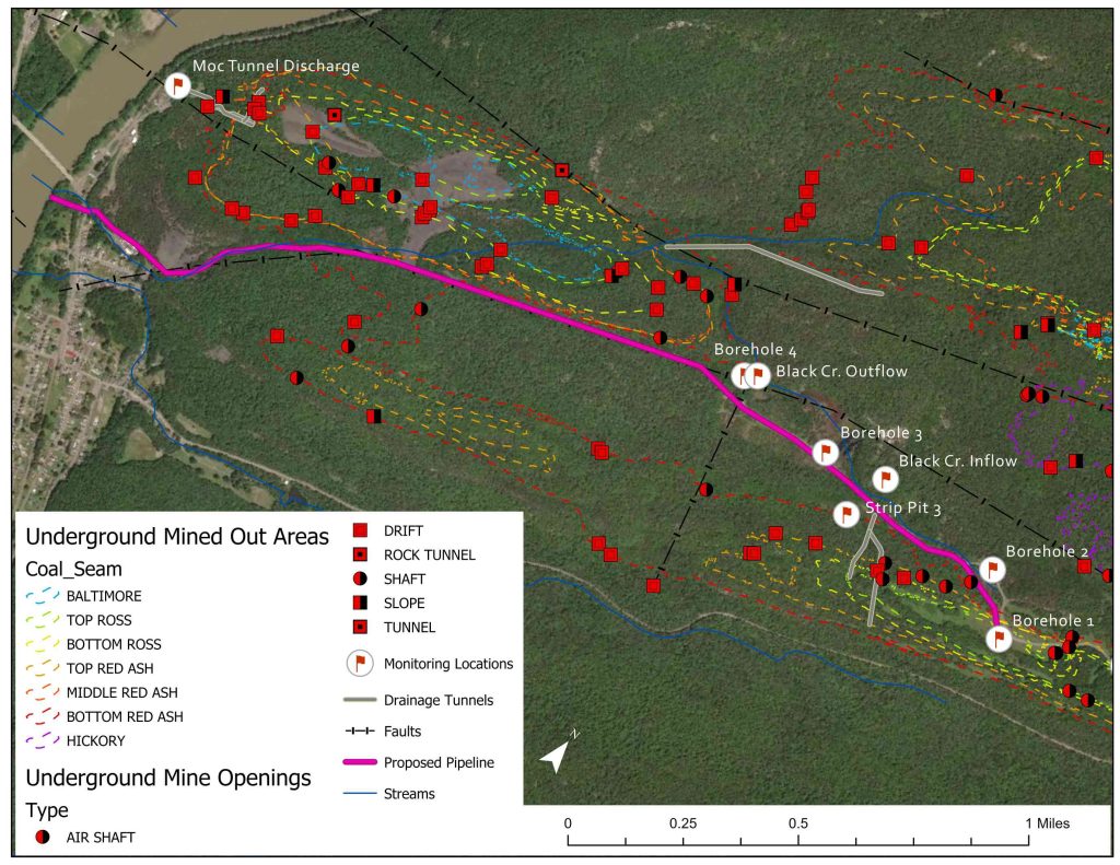
The Leveloggers are deployed on wirelines directly down the monitoring wells (mine pool boreholes) and in PVC stilling wells for the surface water installations.
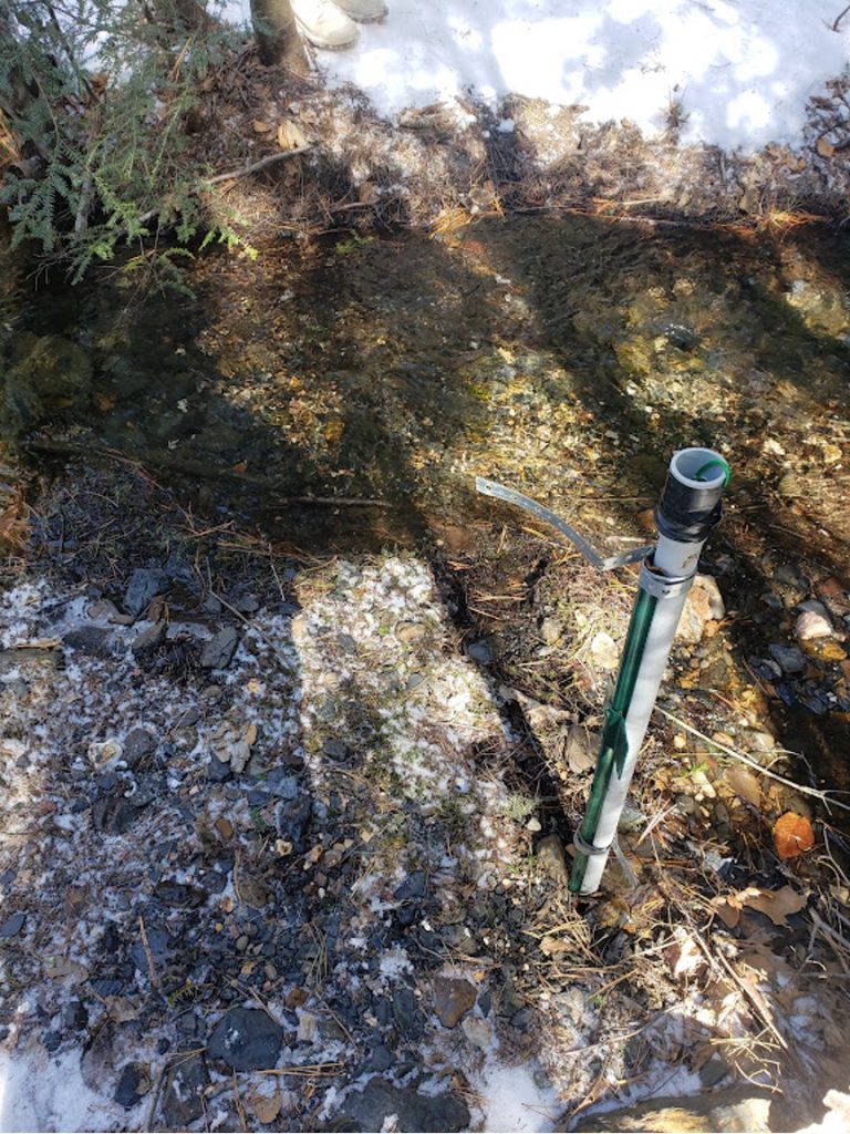
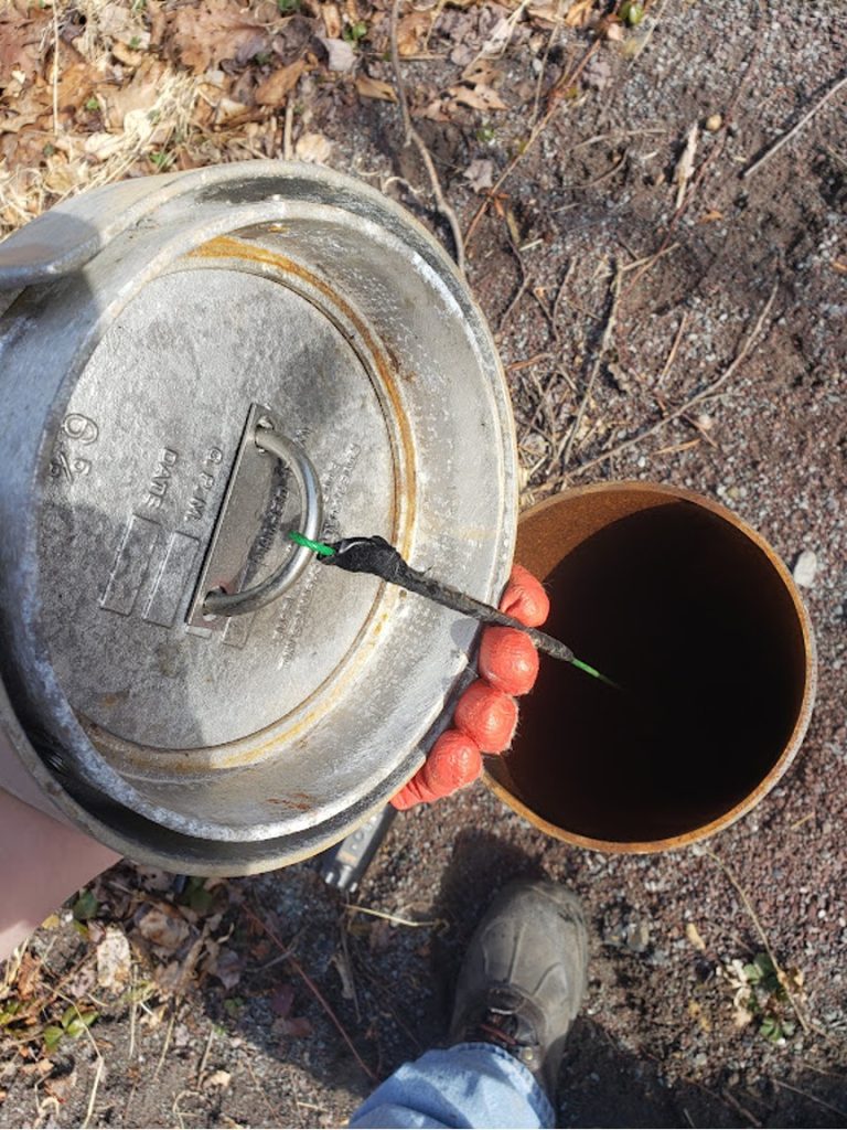
The Leveloggers (and Barologger) are set to record at 15-minute intervals. The data was downloaded monthly while the project was evaluating water quality and flow. The time closest to the 15-minute interval was used, so flow could be related to the water height.
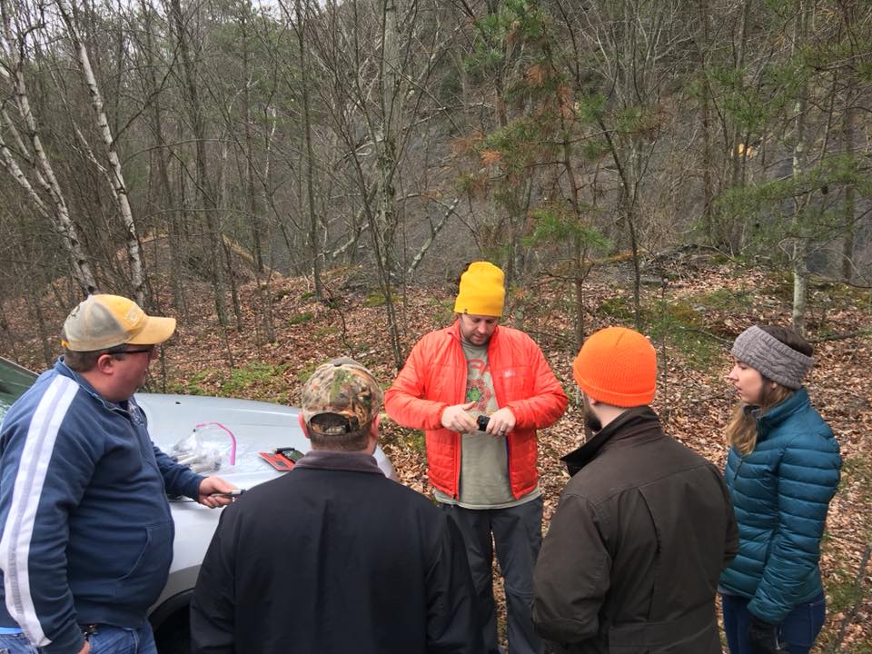
Data were downloaded using a Levelogger App Interface and the Solinst Levelogger App, as well as a Field Reader cable and a laptop. Water level data is stored in Excel spreadsheets after it has been barometrically compensated using the Levelogger software. This allows the data to be used in calculations and graphs for reports.
Interpreting Water Monitoring Results
By interpreting the water level data, different levels of the mine pool below ground were found. Water level data were mapped to show how water moves across the site, down into the underground mines, and out of the tunnel.
The findings provided insight into the ability to manipulate the flows to allow storage of the water during high flow and release it during low flow (like a dam). The data also aided in the creation of a 3D mine pool model where estimates could be made on the volumes of water held in the underground mines.
In addition, the study helped evaluate the effectiveness and estimated costs of different types of mine drainage treatment (e.g., in-situ, passive and active treatment options). As the area was purchased by the state and added to the Pinchot State Forest Tract, the discharge comes from public land. The state would like the discharge to be remediated, along with other hazardous abandoned mine features, as hunters, hikers and rock climbers use this natural area.
Overall, EPCAMR has been pleased with the use of Solinst Leveloggers, since introduced to them in 2018. EPCAMR find Leveloggers to be more cost-effective compared to other similar instruments on the market. Michael A. Hewitt, Program Manager at EPCAMR says “we have grown to like their reliability and function over the years.”
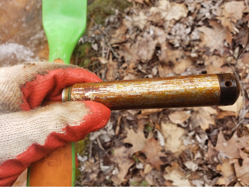
He continues “one I call “trusty rusty” in a stilling well at the polluted water discharge at the Mocanaqua Tunnel has functioned well and still produces data to this day since it was deployed in 2018 (4+ years in harsh conditions)”. Michael notes that they do clean off the accumulated metals periodically but “that is a testament to its quality and longevity.”
Combined with their 3D modelling efforts, the field monitoring project and water level data provide a better picture of water flow through the abandoned mine site, its water storage capacity, and its potential to be treated and discharged as a clean water option for consumptive use mitigation.
The study is contributing to EPCAMR’s overall goal of reclaiming land impacted by past mining practices and getting it back to productive use. It will also help improve the water quality in the region, thereby allowing the areas to be enjoyed by future generations.
Solinst thanks Michael A. Hewitt, EPCAMR Program Manager, and Robert E. Hughes, EPCAMR Executive Director, for providing the details of this project.
